Svetscha
| Urban-type settlement
Svetscha
Свеча
|
||||||||||||||||||||||||||||||
|
||||||||||||||||||||||||||||||
|
||||||||||||||||||||||||||||||
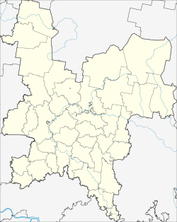
Swetscha ( Russian Свеча ) is an urban-type settlement in Kirov Oblast in Russia with 4760 inhabitants (as of October 14, 2010).
geography
The place is about 130 km as the crow flies west-southwest of the Kirow Oblast Administrative Center on the eponymous Svetscha River, which flows over the Juma to the Pischma .
Svetscha is the administrative center of Svetschinsky Rajons and the seat of the municipality of Svetschinskoje gorodskoje posselenije. This also includes 21 villages and the surrounding area, only one of which - Samoulki, immediately to the west - has over 500 and six more over 100 inhabitants (as of 2010).
history
The place was built in 1903 in connection with the construction of the railway line Saint Petersburg - Vologda - Vyatka , the part of the later Trans-Siberian Railway was. The station built there with the surrounding settlement was named after the river.
On June 10, 1929 Svetscha became the administrative seat of a newly created Rajons named after him. Since 1945 the place has had the status of an urban-type settlement.
Population development
| year | Residents |
|---|---|
| 1939 | 1545 |
| 1959 | 4387 |
| 1970 | 4794 |
| 1979 | 5203 |
| 1989 | 5727 |
| 2002 | 5127 |
| 2010 | 4760 |
Note: census data
traffic
Svetscha has a train station at kilometer 817 (from Moscow ) on the trunk line of the Trans-Siberian Railway, which opened on this section in 1906 and has been electrified since 1969 . Svetscha is the last station belonging to the Severnaya schelesnaja doroga (Northern Railway) area; to the east is the network of the Gorkovskaya schelesnaja doroga (Gorkier Railway).
South of the settlement runs the regional road 33K-004 following the railway line, which, coming from Kotelnitsch , 50 km to the east , continues via the neighboring Leninskoye Rajon center to the 60 km distant border of Kostroma Oblast , and from there in the direction of Ponasyrevo - Sharja .
Web links
Individual evidence
- ↑ a b Itogi Vserossijskoj perepisi naselenija 2010 goda. Tom 1. Čislennostʹ i razmeščenie naselenija (Results of the All-Russian Census 2010. Volume 1. Number and distribution of the population). Tables 5 , pp. 12-209; 11 , pp. 312–979 (download from the website of the Federal Service for State Statistics of the Russian Federation)

