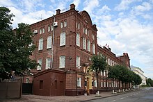
Kostroma Oblast
|
Subject of the Russian Federation
Kostroma Oblast
Костромская область
|
||||||||||||||||||||||||||||||||||||
Coordinates: 58 ° 32 ' N , 44 ° 6' E
The Kostroma Oblast ( Russian Костромская область Kostromskaja oblast ) is an oblast in northwestern Russia .
The Volga flows through the southwestern part of the oblast, besides it occupies a sparsely populated part of the Eastern European plain up to the northern Russian ridge . The climate is temperate continental, around 73% of the area is forested.
The most important branches of industry include wood processing, the textile industry and food processing. Tourism also plays an important role.
history
The region has been inhabited by people since pre-Christian times. Up until the immigration of Slavic tribes between the 9th and 12th centuries, the country was populated by Finno-Ugric ethnic groups. It gradually came under the sovereignty of the Principality of Vladimir-Suzdal and merged with this in the phase of the decline of Mongolian rule from the 14th century in the Grand Duchy of Moscow .
Under Peter the Great , a Kostroma province was formed within the Moscow governorate in 1708 , from which the extended Kostroma governorship emerged in 1778 . This was transformed into the Kostroma Governorate in 1797 , which existed until the Soviet period, when it became part of the Iwanowo industrial oblast (Ivanovskaya Promyslennaya oblast) on October 14, 1929 and within this initially (until 1930) formed an okrug .
The Kostroma Oblast as part of the Russian SFSR of the Soviet Union was formed on August 13, 1944 from parts of the four oblasts of Yaroslavl , Ivanovo , Gorky and Vologda, which were formed in the 1930s .
Administrative divisions and cities
The Kostroma Oblast is divided into 24 Rajons and 6 urban districts . The only major city is the administrative center of the oblast, Kostroma . There are a total of twelve cities and seven urban-type settlements in the oblast .
| Surname | Russian | Residents (October 14, 2010) |
|---|---|---|
| Kostroma | Кострома | 268,742 |
| Bui | Буй | 25,763 |
| Sharia | Шарья | 23,681 |
| Nerechta | Нерехта | 22,828 |
| Manturovo | Мантурово | 17,479 |
| Galitsch | Галич | 17,346 |
| Volgorechensk | Волгореченск | 17,104 |
population
In the last Russian censuses in 2002 and 2010, there were 736,641 and 667,562 residents, respectively. The number of inhabitants thus fell by 69,079 people (−9.4%) in these eight years. The distribution of the different ethnic groups was as follows:
| nationality | VZ 1989 | percent | VZ 2002 | percent | VZ 2010 | percent |
|---|---|---|---|---|---|---|
| Russians | 774.620 | 96.31 | 704.049 | 95.58 | 622.444 | 93.24 |
| Ukrainians | 9,723 | 1.21 | 8,011 | 1.09 | 5,650 | 0.85 |
| Tatars | 2,965 | 0.37 | 2,731 | 0.37 | 2.224 | 0.33 |
| Armenians | 565 | 0.07 | 1,462 | 0.20 | 1,656 | 0.25 |
| Zigane | 1,412 | 0.18 | 1,542 | 0.21 | 1,519 | 0.23 |
| Belarusians | 2,891 | 0.36 | 2,354 | 0.32 | 1,490 | 0.22 |
| Azerbaijanis | 994 | 0.12 | 1,438 | 0.20 | 1,291 | 0.19 |
| Tschuwaschen | 1,171 | 0.15 | 943 | 0.13 | 748 | 0.11 |
| Moldovans | 1,606 | 0.20 | 1,036 | 0.14 | 859 | 0.13 |
| German | 450 | 0.06 | 658 | 0.09 | 427 | 0.06 |
| Residents | 804.296 | 100.00 | 736,641 | 100.00 | 667,562 | 100.00 |
Note: the proportions refer to the total number of inhabitants. Including the group of people who did not provide any information about their ethnic affiliation (2002 5,862 and 2010 23,194 people)
The area's population is almost entirely Russian. The majority of the small ethnic minority groups are shrinking.
Web links
Individual evidence
- ↑ Administrativno-territorialʹnoe delenie po subʺektam Rossijskoj Federacii na 1 janvarja 2010 goda (administrative-territorial division according to subjects of the Russian Federation as of January 1, 2010). ( Download from the website of the Federal Service for State Statistics of the Russian Federation)
- ↑ a b Itogi Vserossijskoj perepisi naselenija 2010 goda. Tom 1. Čislennostʹ i razmeščenie naselenija (Results of the All-Russian Census 2010. Volume 1. Number and distribution of the population). Tables 5 , pp. 12-209; 11 , pp. 312–979 (download from the website of the Federal Service for State Statistics of the Russian Federation)
- ↑ Ukas of the Presidium of the Supreme Soviet of August 13, 1944 (Russian)


