Oparino (Kirov)
| Urban-type settlement
Oparino
Опарино
|
||||||||||||||||||||||||||||||
|
||||||||||||||||||||||||||||||
|
||||||||||||||||||||||||||||||
Oparino ( Russian Опа́рино ) is an urban-type settlement in Kirov Oblast in Russia with 4,440 inhabitants (as of October 14, 2010).
geography
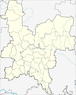
The place is about 160 km as the crow flies northwest of the Kirov Oblast Administrative Center a good 10 km from the border with the Komi Republic . It is located a few kilometers from the left bank of the upper reaches of the Lusa .
Oparino is the administrative center of Oparinsky Rajon and the seat of the municipality of Oparinskoye gorodskoje posselenije, which also includes the village of Kultura (2 km southwest) and the settlements Latyshsky (12 km northwest) and Chursja (25 km northwest, on the territory of the Komi Republic).
history
The place was created in 1899 in connection with the construction of the railway line ( Perm -) Vyatka - Kotlas . It initially belonged to the Ujesd Nikolsk of the Vologda Governorate and in 1911 became the seat of a Volost .
On April 10, 1924, Oparino became the administrative seat of a newly created Rajons named after him, initially part of the Northern Dvina Governorate , from 1929 the Northern Krai , from 1936 the Northern Oblast , from 1937 the Arkhangelsk Oblast and finally the Oblast from January 17, 1941 Kirov. In 1942 the place received the status of an urban-type settlement. From December 1, 1959 to December 30, 1966, the Rajon was temporarily dissolved, and Oparino belonged to the Muraschinski rajon .
Population development
| year | Residents |
|---|---|
| 1939 | 3709 |
| 1959 | 6485 |
| 1970 | 6576 |
| 1979 | 6880 |
| 1989 | 5862 |
| 2002 | 5142 |
| 2010 | 4440 |
Note: census data
traffic
Oparino has a train station at kilometer 185 of the Kirov - Kotlas railway line opened in 1899. The narrow-gauge Oparino forest railway has been in operation in a north-easterly direction since the 1950s . In the 1970s, their network had a maximum expansion of over 150 km, today (2016) it was still around 75 km.
After Oparino the regional road 33R-026, in the south-east of neighboring, over 60 km away Rajonzentrum leads murashi by the federal highway R176 Vyatka Cheboksary - Syktyvkar branches and part of the compound under construction Kirov - Kotlas - Arkhangelsk is. In a south-westerly direction, the 33N-080 branches off into the neighboring district of Darowskoi , about 120 km away .
Web links
Individual evidence
- ↑ a b Itogi Vserossijskoj perepisi naselenija 2010 goda. Tom 1. Čislennostʹ i razmeščenie naselenija (Results of the All-Russian Census 2010. Volume 1. Number and distribution of the population). Tables 5 , pp. 12-209; 11 , pp. 312–979 (download from the website of the Federal Service for State Statistics of the Russian Federation)


