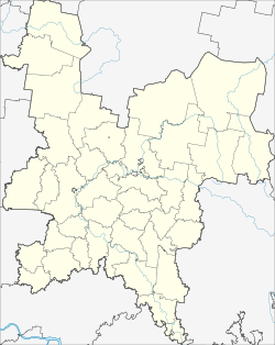
Omutninsk
| city
Omutninsk
Омутнинск
|
||||||||||||||||||||||||||||||||||||||
|
||||||||||||||||||||||||||||||||||||||
|
||||||||||||||||||||||||||||||||||||||
| List of cities in Russia | ||||||||||||||||||||||||||||||||||||||
Omutninsk ( Russian Омутнинск ) is a city in Kirov Oblast ( Russia ) with 23,615 inhabitants (as of October 14, 2010).
geography
The city is located about 190 km east of the Oblast capital Kirov at the confluence of the Omutnaja in the Vyatka , a right tributary of the Kama .
Omutninsk is the administrative center of the raion of the same name .
history
The place was created in 1773 in connection with the establishment of an iron foundry under the name Ossokino after the family name of the founder Lieutenant Colonel Ossokin. Later, however, the name Omutninski Zavod became popular after the river. In 1921 the place was given city rights under its current name.
Population development
| year | Residents |
|---|---|
| 1926 | 6,400 |
| 1939 | 17,383 |
| 1959 | 24,789 |
| 1970 | 28,777 |
| 1979 | 28,497 |
| 1989 | 29,248 |
| 2002 | 26,065 |
| 2010 | 23,615 |
Note: census data (1926 rounded)
Individual evidence
- ↑ a b Itogi Vserossijskoj perepisi naselenija 2010 goda. Tom 1. Čislennostʹ i razmeščenie naselenija (Results of the All-Russian Census 2010. Volume 1. Number and distribution of the population). Tables 5 , pp. 12-209; 11 , pp. 312–979 (download from the website of the Federal Service for State Statistics of the Russian Federation)
Web links
- City's unofficial website (Russian)
- Omutninsk on mojgorod.ru (Russian)


