Luxemburger Strasse (Trier)
| Luxemburger Strasse | |
|---|---|
| Street in Trier | |
| Basic data | |
| place | trier |
| District | West , yours , Zewen |
| Hist. Names | Your road |
| Connecting roads | Aachener Strasse , Zewener Strasse |
| Cross streets | Römerbrücke / Eurener Straße (Trier-West railway bridge), Lambertistraße, Konrad-Adenauer-Brücke / Im Speyer, Teichweg, Eisenbahnstraße, Diedenhofener Straße, Gottbillstraße (several junctions), Niederkircher Straße, Alte Monaiser Straße |
| Buildings | Roman bridge |
| Technical specifications | |
| Street length | 4.4 km |
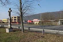
The Luxemburger Straße is a street in Trier in the districts West and Euren ; in the most south-westerly section it forms the border between Euren and Zewen .
course
The street leads from the Römerbrücke as an eastern extension of Aachener Straße through the entire industrial area of Euren and Zewen to the outskirts of Zewen and there it merges into Zewener Straße. At 4.4 kilometers, it is the longest street in the city. Several side streets branching off from the street, which are used to develop commercial businesses, also bear the name Luxemburger Straße.
Between the Römerbrücke in Pallien and the Konrad-Adenauer-Brücke in Euren, it is part of the B 51 , which runs to Saarbrücken when coming from the Eifel ; From here it is part of the B 49 , which , coming from Koblenz , leads via Igel to the border crossing at Langsur or Wasserbillig and thus connects Trier with the Grand Duchy of Luxembourg .
history
The road runs on an old Roman road that connected Trier with Reims . The street is named after Luxembourg City , the capital of the small Grand Duchy of the same name. Before 1883 the street was called Eurener Chaussee . In addition, in the Middle Ages and in the early modern period, the border with Luxembourg was near Zewen, at the edge of which the roads end.
Buildings and businesses on the street
Several cultural monuments from the late 19th century can be found in the northeastern section of the street closest to the city center. There is also a well-known brothel - the Eros-Center -, the rock disco Lucky's Luke directly on the Römerbrücke , as well as various facades of still used and no longer used businesses. The north-eastern part of the road runs directly parallel to the banks of the Moselle , which, however, is hardly noticeable from the road due to the development. There is a campsite and the Treviris 1921 rowing club on the banks of the river . In 1993 the exhibition park was opened on the street . To the south-west of Messepark and Konrad-Adenauer-Brücke, Luxemburger Strasse only serves as a thoroughfare; almost all of the commercial and industrial companies located there cannot be reached directly from Luxemburger Strasse, but rather via side streets. Much of the street is an avenue of lime trees, which is a natural monument .
literature
- General Directorate for Cultural Heritage Rhineland-Palatinate (publisher): Informational directory of cultural monuments of the district-free city of Trier . Koblenz 2010 ( gdke-rlp.de [PDF; 1,2 MB ; accessed on September 7, 2015]).
- Patrick Ostermann (arrangement): City of Trier. Old town. (= Cultural monuments in Rhineland-Palatinate. Monument topography Federal Republic of Germany . Volume 17.1 ). Wernersche Verlagsgesellschaft, Worms 2001, ISBN 3-88462-171-8 .
- Ulrike Weber (arrangement): City of Trier. City expansion and districts. (= Cultural monuments in Rhineland-Palatinate. Monument topography Federal Republic of Germany . Volume 17.2 ). Wernersche Verlagsgesellschaft, Worms 2009, ISBN 978-3-88462-275-9 .
- Emil Zenz: Street names of the city of Trier: their meaning and their meaning . Ed .: Culture Office of the City of Trier. 5th edition. Trier 2006, DNB 455807825 (first edition: 1961).
Individual evidence
- ^ Emil Zenz: Street names of the city of Trier: their sense and their meaning . Ed .: Culture Office of the City of Trier. 5th edition. Trier 2006, DNB 455807825 (1st edition 1961).
- ↑ Josef Fisch: Small Zewener Chronicle. Volumes 1–5, self-published, Trier 1970.
- ↑ General Directorate for Cultural Heritage Rhineland-Palatinate (ed.): Informational directory of cultural monuments in the district-free city of Trier . Koblenz 2010 ( gdke-rlp.de [PDF; 1,2 MB ; accessed on September 7, 2015]).
- ↑ Rowing Club Treviris 1921 Trier: Rowing on the Moselle in the rowing club Treviris 1921 eV Trier. Retrieved July 5, 2017 .
- ^ Oliver Wittkowski: Luxemburger Strasse. In: This country. SWR television in Rhineland-Palatinate, April 15, 2013, accessed on September 7, 2015 .
- ↑ Trier Exhibition Park. City of Trier, 2015, accessed on September 7, 2015 .
- ^ Entry on Luxemburger Strasse in the database of cultural assets in the Trier region ; accessed on March 11, 2016.
- ↑ Nature Conservation Administration Rhineland-Palatinate: Landscape Information System of the Nature Conservation Administration Rhineland-Palatinate; Retrieved July 29, 2013
