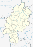
Mönchhof (Raunheim)
|
Mönchhof
City of Raunheim and Kelsterbach
Coordinates: 50 ° 1 ′ 52 ″ N , 8 ° 28 ′ 18 ″ E
|
|
|---|---|
| Incorporated into: | Raunheim and Kelsterbach |
| Postal code : | 65479 (Raunheim) |
| Area code : | 06142 (Raunheim) |
|
Place name sign for Mönchhof / City of Raunheim / City of Kelsterbach
|
|
The Mönchhof , formerly called Wüsteneddersheim , is now a district or a logistics and industrial park of Raunheim and Kelsterbach , southwest of Frankfurt am Main .
history
Originally the Mönchhof was from 1290 to 1781 monastery property of the Reichklarakloster (Mainz) , after the secularization an estate in the possession of the Grand Ducal Hessian house and asset management or state domain of the state of Hesse . The site is located in the north of the Raunheim am Main district and has a size of approx. 110 hectares . The only structural remnant of the Mönchhof is the historically valuable Mönchhof Chapel from 1687.
The Grand Ducal Hessian Economist Friedrich Weber (1841–1917) took over the Mönchhof in 1875 as a tenant; his descendants managed the estate until the early 1960s. There has been a siding since 1889. A distillery building was built at the end of the 19th century.
After the Second World War , the area belonged to the State of Hesse. After being sold to two chemical companies in the early 1960s, the Caltex Raunheim refinery was built there in 1962 . This was used until the 1980s. Fraport AG then bought the site because it is in the immediate vicinity of Frankfurt Airport. The refineries were dismantled in order to avoid endangering the north-west runway planned later in the 2000s. Instead, a logistics and office location has been built since 2004.
Culture and sights
Buildings
- The Mönchhof chapel (Raunheim) was renovated in 2008
- Eddersheim barrage
Green spaces and recreation
Since 2004, the foreland of the Main has been expanded significantly for species and biotope protection and recreational use. The forest adjoining the area to the east is called Mönchwald .
Economy and Infrastructure
Business park
50 ° 2 '4.9 " N , 8 ° 28" 55.9 " E
The area was sold on June 30, 1961 by the Hessian state government ( Cabinet Zinn III ) to the Hoechst and Caltex paintworks in order to build a refinery there. From 1964 to 1984 it operated an oil refinery with striking tank farms, which could be seen from the federal motorway 3 and the aircraft taking off and landing at the neighboring Frankfurt am Main airport . A good 600 people annually process up to 2.8 million tons of crude oil into gasoline, diesel, heating oil and kerosene. The crude oil arrived here from Rotterdam initially by ship and later via a pipeline. On the 84 hectare Caltex area, after the shutdown and dismantling of the facilities, the Mönchhof industrial park has been developed as a logistics and office location by Fraport AG since 2004 . In September 2007 construction began on the first part of the building. Since then, companies from the logistics, wholesale and retail sectors have established their logistics and shipping centers. Full marketing of the commercial space should be achieved by 2019.
traffic
As a logistics and industrial park, Mönchhof is conveniently located on federal highway 43 and connected to federal freeway 3 via the Raunheim motorway junction . Via the Mönchhof triangle you get to the federal motorway 67 . There is also the Eddersheim am Main barrage in the immediate vicinity .
Web links
- Project description, data & facts as well as impressions from the Mönchhof site on frankfurt-airport.de
- With DHL-Express on the Raunheimer Mönchhof site, up to 3800 shipments per hour can be processed by Michael Kapp on main-spizte.de from August 18, 2012


