Kaafu
| Malé Atholhu (Kaafu) |
|
|---|---|

|
|
| geography | |
| Country: | Maldives |
| Waters: | Laccadive Lake |
| Islands: | 107 |
| Geographical location: | 4 ° 25 ′ N , 73 ° 30 ′ E |
| Basic data | |
| Surface: | 4.77 km² |
| Residents: | 10,896 |
| Population density: | 23 inhabitants / km² |
| Capital: | Thulusdhoo |
| Situation map | |
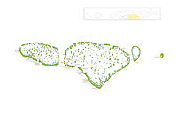
Malé Atholhu ( Malé Atoll , Dhivehi މާލެ އަތޮޅު), with the Thaana letter identifierކ( Kaafu ), is an administrative area ( administrative atoll ) in the central east chain of the Maldives with 10,896 inhabitants (status: 2006).
The Kaafu administrative area includes the following atolls (from north to south) :
The islands of Malé , Hulhumalé , Villingili and Hulhulé in the south of the North Malé Atoll do not belong to the administrative area of Kaafu, but are administered directly from the Maldivian capital Malé .
Thulusdhoo , the capital of the administrative region Kaafu, is located on the island of the same name in the east of the North Malé Atoll.
Kaafu consists of a total of 107 islands, 10 of which are inhabited.
