Mamer (river)
| Mamer | ||
|
Location of the Mamer |
||
| Data | ||
| Water code | LU : VI-11 | |
| location | Luxembourg | |
| River system | Rhine | |
| Drain over | Alzette → Sauer → Moselle → Rhine → North Sea | |
| source | at Garnich - Hivange 49 ° 36 '26 " N , 5 ° 56' 3" O |
|
| Source height | 333 m | |
| muzzle | at Mersch in the Alzette coordinates: 49 ° 44 ′ 55 " N , 6 ° 6 ′ 28" E 49 ° 44 ′ 55 " N , 6 ° 6 ′ 28" E |
|
| Mouth height | 214 m | |
| Height difference | 119 m | |
| Bottom slope | 4.5 ‰ | |
| length | 26.7 km | |
| Discharge at the gauge Schoenfels A Eo : 83.6 km² Location: 3.79 km above the mouth |
NNQ (08/18/1963) MNQ 2002/2012 MQ 2002/2012 Mq 2002/2012 MHQ 2002/2012 HHQ (01/07/2011) |
202 l / s 228 l / s 963 l / s 11.5 l / (s km²) 20.5 m³ / s 31.1 m³ / s |
|
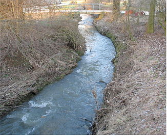
The Mamer at Holzem |
||
The Mamer is a 27 km long left tributary of the Alzette in Luxembourg.
geography
course
The Mamer rises east of Hivingen at an altitude of 359 m .
It flows through the villages of Holzem , Mamer , Kopstal and Schoenfels . It finally flows into the Alzette from the left at a height of 214 m near Mersch a few meters before the Eisch .
Tributaries
- Wëlleschbaach ( left ), 2.3 km, 1.38 km², at Holzemermillen , 300 m
- Bräderbaach ( right ), 2.9 km, at Holzem , 297 m
- Faulbaach ( left ), 0.7 km (with Meneschbach 5.3 km), in Mamer , 285 m
- Kielbaach ( left ), 7.6 km, at Thillsmillen , 265 m
- Riedelbaach ( Rielbaach ) ( left ), 1.6 km, at Neimaxmillen 264 m
- Lédeleschbur (left), 1.5 km, north-northeast of Kopstal
Web links
Commons : Mamer River - collection of pictures, videos and audio files
- History of the Mamer on the Geoportal Luxembourg
- Station: Schoenfels / Mamer
Individual evidence
- ↑ a b Geoportal Luxembourg
- ↑ Implementation of the European Water Framework Directive (2000/60 / EC) Report on the inventory for Luxembourg 2014
- ↑ Upper course
- ↑ Measured over the longest source branch, the portal ends at 4.4 km

