Marysville (Ohio)
| Marysville | |
|---|---|
| Nickname : The Shaded City | |
 Junction of State Routes 31 and 38 |
|
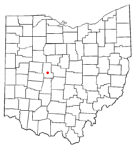
| Location in Ohio | |
| Basic data | |
| Foundation : | 1816 |
| State : | United States |
| State : | Ohio |
| County : | Union County |
| Coordinates : | 40 ° 14 ′ N , 83 ° 22 ′ W |
| Time zone : | Eastern ( UTC − 5 / −4 ) |
| Residents : | 22.094 (as of 2010) |
| Population density : | 543.7 inhabitants per km 2 |
| Area : | 40.84 km 2 (approx. 16 mi 2 ) of which 40.64 km 2 (approx. 16 mi 2 ) is land |
| Height : | 302 m |
| Postcodes : | 43040, 43041 |
| Area code : | +1 937 |
| FIPS : | 39-48160 |
| GNIS ID : | 1061480 |
| Website : | www.marysvilleohio.org |
| Mayor : | John Gore |
Marysville is a city in Union County , Ohio , United States . It is the administrative headquarters of Union County. The population at the 2010 census was 22,094.
The city is named after the daughter Mary of the founder Samuel W. Cuthbertson.
geography
According to the United States Census Bureau , the city has a total area of 40.4 km², 40.2 km of which is land and 0.2 km² is water.
Marysville is located at the intersection of various highways, these are bypassed west, north and east of the center by a bypass, only Ohio State Route 38 runs as Main Street in a north-south direction through the center of the city. The bypass road is formed by partially overlapping sections of US Highway 33 , US Highway 36 , Ohio State Route 4 . Ohio State Route 31 and Ohio State Route 245 end at the bypass . The Penn Central railroad runs through town, through which Mill Creek meanders.
Demographics
At the time of the 2010 United States Census, Marysville was inhabited by 22,094 people. The population density was 546.9 people per km ². There were 7,314 housing units at an average of 181 per km ². Marysville's population was 90.4% White , 4.5% Black or African American , 0.3% Native American , 2.3% Asian , 0.1% Pacific Islander , and 0.6% said other races belong to and 1.8% mentioned two or more races. 1.8% of the population declared to be Hispanic or Latino of any race.
The residents of Marysville distributed to 7,314 households out of which 41.7% were living in children under 18 years of age. 53.1% of households were married, 11.6% had a female head of household without a husband, and 31% were not families. 25.2% of households were made up of individuals and someone lived in 8.1% of all households aged 65 years or older. The average household size was 2.6 and the average family size was 3.16.
The population was divided into 28.8% minors, 6.4% 20–24 year olds, 36.1% 25–44 year olds, 20.7% 45–64 year olds and 8.1% aged 65 and over or more. The mean age was 33.8 years. For every 100 women there were 76.3 men. For every 100 women over 19, there were 66.4 men.
The median household income in Marysville was 66,233 US dollars and the median family income reached the amount of 79,158 US dollars. The median income for men was $ 55,464 compared with $ 40,973 for women. The per capita income was $ 22,109. 6.7% of the population and 5.3% of families had an income below the poverty line , including 6.8% of minors and 8.9% of those over 65 years of age.
Of the residents of Maryville with European descent, 30.3% profess to have German ancestors, 17.3% to ancestry of Irish and 10.8% to English ancestry. 4.5% of the population say they have roots in Italy and 3.9% are descendants of French immigrants.
economy
Marysville is a major Honda location in the United States. From 1979 to 2009, Honda motorcycles were built at the Marysville Motorcycle Plant . With the Marysville Auto Plant, there has been a second Honda location in the city since 1982. The Honda Accord , Honda NSX and several Acura models , among others, are manufactured in Marysville .
Personalities
- Robert S. Beightler , general and civil engineer
- Chase Blackburn , professional football player
- Arthur E. Drumm , inventor and industrialist
- Darren Hall , professional baseball player
- Cornelius S. Hamilton (1821–1867), US Congressman
- John F. Kinney (1816–1902), lawyer and politician
- Preston B. Plumb (1837-1891), US Senator
- James E. Robinson , Ohio Supreme Court Justice
- James Wallace Robinson (1826–1898), US Congressman
- Gary Shirk , professional football player
- Thomas B. Ward (1835-1892), US Congressman
Twin cities
Web links
- Central Ohio History (English)
Individual evidence
- ^ Our Operations - Marysville , at www.ohio.honda.com , accessed July 12, 2016
