Matagalpa (city)
| Matagalpa | ||
|---|---|---|
|
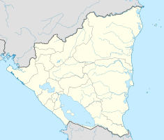
Coordinates: 12 ° 56 ' N , 85 ° 55' W Matagalpa on the map of Nicaragua
|
||
| Basic data | ||
| Country | Nicaragua | |
| Department | Matagalpa | |
| City foundation | 1851 | |
| Residents | 130,000 (2010) | |
| - in the metropolitan area | 542,000 | |
| City insignia | ||
| Detailed data | ||
| surface | 675 km 2 | |
| Population density | 193 inhabitants / km 2 | |
| height | 680 m | |
| City structure | 7 distritos | |
| Post Code | 61000 | |
| prefix | +505 | |
| Time zone | UTC −6 | |
| City Presidency | Sadrach Zeledón | |
| Website | ||
| Matagalpa, 1988 | ||
Matagalpa is the capital of the Matagalpa department , with 485,500 inhabitants the second largest administrative district in Nicaragua . The municipality of Matagalpa has about 200,000 inhabitants. Around 120,000 of them live in the city and around 80,000 in the surrounding area. Matagalpa lies at an altitude of 681 meters above sea level .
geography
The city is located 132 kilometers north of Nicaragua's capital Managua . The municipal area is 64,065 square kilometers and borders on the municipality of Jinotega to the north, the municipality of Tuma (La Dalia, San Ramón and Muy Muy) to the east, the municipality of Esquipulas y San Dionisio to the south and the municipality of Sebaco.
history
Before the arrival of the Spaniards, there were Indian settlements in the area, one of which was called Matagalpa or Pueblo Grande . The other two were named Solingalpa and Molagüina . Matagalpa received city rights on February 14, 1862 .
On December 19, 1924, the Roman Catholic diocese of Matagalpa was established.
economy
Matagalpa makes a significant contribution to Nicaragua's gross domestic product . Economically, Matagalpa is in second place after Managua. The relative wealth of the city comes from the fact that Matagalpa is the center of coffee growing in Nicaragua. A large part of the income comes from this source. Beans, corn and vegetables are also grown. Recently, flowers have also been grown for export.
sons and daughters of the town
- Tomás Borge (1930–2012), politician and writer, co-founder of the FSLN
- Carlos Fonseca (1936–1976), co-founder of the FSLN
- Dora María Téllez (* 1955), writer, historian and former guerrilla fighter of the Sandinistas
Town twinning
| city | country | since |
|---|---|---|
| Gainesville |
|
after 1991 |
| Sabadell |
|
1987 |
| Tilburg |
|
1987 |
| Oulu |
|
1986 |
| Wuppertal |
|
1987 |
Web links
Individual evidence
- ^ Sister Cities presence coming downtown - Gainesville.com. Retrieved November 14, 2015 .
- ↑ fons - Results page 1. Retrieved November 14, 2015 .
- ↑ What is the stedenband? Retrieved November 14, 2015 .
- ↑ Historial de la Escuela Solingalpa - Wed Matagalpa. (No longer available online.) Archived from the original on November 17, 2015 ; accessed on November 14, 2015 . Info: The archive link was inserted automatically and has not yet been checked. Please check the original and archive link according to the instructions and then remove this notice.
- ↑ Partneri- ja kummikaupungit - Kansainväliset yhteydet - Oulun kaupunki. Retrieved November 14, 2015 .
- ^ City of Wuppertal - Matagalpa. (No longer available online.) Archived from the original on November 17, 2015 ; accessed on November 14, 2015 . Info: The archive link was inserted automatically and has not yet been checked. Please check the original and archive link according to the instructions and then remove this notice.


