Mavila
| Mavila | ||
|---|---|---|
|
|
||
| Coordinates | 11 ° 56 ′ S , 69 ° 7 ′ W | |
| Basic data | ||
| Country | Peru | |
| Madre de Dios | ||
| province | Tambopata | |
| ISO 3166-2 | PE-MDD | |
| District | Las Piedras | |
| height | 234 m | |
| Residents | 1454 (2017) | |
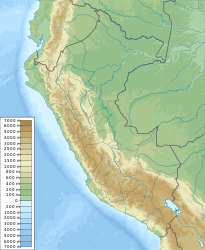
Mavila is a village in the southeastern part of the South American Andean state of Peru . In the 2017 census, the population was 1,454.
Mavila is located in the district of Las Piedras in the province of Tambopata in the region Madre de Dios at an altitude of 234 m on the right, the south bank of the Río Manuripe , straddling the border to 34 km to the east Bolivia crossed and after a further 433 km in the village of Puerto Rico flows into the Río Orthon , a tributary of the Río Beni .
The Transoceánica , which connects São Paulo in Brazil with Lima in Peru, runs through Mavila . Section 3 of the Transoceánica leads from Iñapari on the Peruvian-Brazilian border via Iberia and Alerta to Mavila and on via Puerto Maldonado to Mazuko .
The region's climate is semi-humid and very humid with 2000 mm of annual precipitation, from November to March there is an average of between 200 and 300 mm of rain, only in June and July the values fall below 50 mm. The annual average temperature is 25.6 ° C, and the monthly values fluctuate only slightly between 23 ° C in July and 26.5 ° C in December and January.
Individual evidence
- ↑ PERU: Region Madre de Dios: Provinces & Places . www.citypopulation.de. Retrieved December 28, 2019.
- ↑ GEO travel community ( accessed May 27, 2012 )
