
Merenye
| Merenye | |||||
|
|||||
| Basic data | |||||
|---|---|---|---|---|---|
| State : | Hungary | ||||
| Region : | Southern Transdanubia | ||||
| County : | Baranya | ||||
| Small area until December 31, 2012 : | Szigetvár | ||||
| District since 1.1.2013 : | Szigetvár | ||||
| Coordinates : | 46 ° 4 ' N , 17 ° 42' E | ||||
| Area : | 14.47 km² | ||||
| Residents : | 273 (Jan. 1, 2011) | ||||
| Population density : | 19 inhabitants per km² | ||||
| Telephone code : | (+36) 73 | ||||
| Postal code : | 7981 | ||||
| KSH kódja: | 07737 | ||||
| Structure and administration (as of 2020) | |||||
| Community type : | local community | ||||
| Mayor : | István Verkman (independent) | ||||
| Postal address : | Kossuth Lajos u. 61 7981 Merenye |
||||
| (Source: A Magyar Köztársaság helységnévkönyve 2011. január 1st at Központi statisztikai hivatal ) | |||||


Merenye is a Hungarian community in the county Szigetvár in Baranya . The northern district of Ceglédpuszta belongs to the municipality.
Geographical location
Merenye is eight and a half kilometers northwest of the district town of Szigetvár .
history
Merenye was first mentioned in 1192.
Attractions
- Reformed Church, built in 1781 (Baroque)
- Reservoir ( Merenyei víztároló )

reformed Church

Kossuth Lajos utca
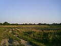
Landscape near Mereye


traffic
Merenye can only be reached via the secondary road no.66166; main road no.6 runs four kilometers to the south . The nearest train station is six kilometers south in Nemeske .
Individual evidence
- ↑ Helyi önkormányzati választások 2019 - Merenye (Baranya megye). Nemzeti Választási Iroda, October 13, 2019, accessed June 14, 2020 (Hungarian).
Web links
Commons : Merenye - collection of images, videos and audio files