Mineral del Chico
| Mineral del Chico | ||
|---|---|---|
|
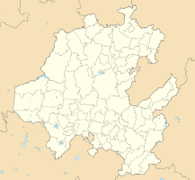
Coordinates: 20 ° 13 ′ N , 98 ° 44 ′ W Mineral del Chico on the map of Hidalgo
|
||
| Basic data | ||
| Country | Mexico | |
| State | Hidalgo | |
| Municipio | Mineral del Chico | |
| Residents | 481 (2010) | |
| City insignia | ||
| Detailed data | ||
| surface | 0.95 km 2 | |
| Population density | 506 inhabitants / km 2 | |
| height | 2340 m | |
| Website | ||
| Mineral del Chico - town view | ||
| Mineral del Chico - Church | ||
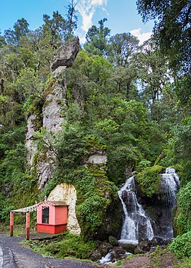
| Mineral del Chico - waterfall | ||
Mineral del Chico is a place with about 500 inhabitants and capital of the approximately 10,000 inhabitants counting municipality of the same name (municipio) in the center of the Mexican state Hidalgo . Because of its colonial character, the place is one of the Pueblos Mágicos .
Location and climate
The city of Mineral del Chico is located in the wooded mountains of the Sierra de Pachuca on the northern edge of the El Chico National Park in the Mexican highlands about 143 km (driving distance) northeast of Mexico City at an altitude of about 2340 m ; Pachuca de Soto , the capital of the state of Hidalgo, is only 30 km to the south. The climate is temperate to mild; The rain, which is abundant by Mexican standards (approx. 1065 mm / year), comes from the Atlantic or the Gulf of Mexico and falls mainly during the summer months .
population
| year | 2000 | 2005 | 2010 |
| Residents | 486 | 502 | 481 |
Only a small part of the population is of Spanish descent; Colloquial languages are Spanish and a regional Nahuatl dialect.
economy
Formerly a small mining town, the inhabitants now make their living from agriculture, which also includes fruit growing and small livestock farming; in addition, forestry plays a not insignificant role. Small traders, craftsmen and service providers of all kinds have set up shop in the village, providing the growing number of day tourists with everything they need.
history
The year 1565 is given as the founding year of the mountain village, whose original name was Atotonilco . Only after the independence of Mexico (1821) did it receive its current name and in 1869 the city rights.
Attractions
- The small mountain village is idyllically located in the wooded mountains of the Sierra de Pachuca .
- The parish church of the Virgen de la Purísima Concepción is dedicated to the Immaculate Conception of Mary . The current church with its baroque tower dates from 1725; however, it was redesigned in the neoclassical style in the early 19th century. The nave is vaulted; the crossing is covered by a dome resting on a windowed drum with a lantern on it .
- Surroundings
- Immediately next to a waterfall (cascada) is a small chapel.


