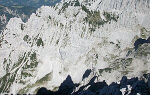
Mitterkaiser
| Mitterkaiser | ||
|---|---|---|
|
Mitterkaiser from the west, far left the north peak, left the main peak, further right the south peak (highest point), far right at the saddle the Fritz-Pflaum hut, in front the Große Griesener Tor (Hochkar) |
||
| height | 2007 m above sea level A. | |
| location | Tyrol , Austria | |
| Mountains | Kaiser Mountains | |
| Dominance | 0.5 km → Kleinkaiser | |
| Notch height | 162 m ↓ notch at the Fritz-Pflaum-Hütte | |
| Coordinates | 47 ° 34 '3 " N , 12 ° 20' 13" E | |
|
|
||
| Normal way | from the Fritz-Pflaum-Hütte ( II ) | |
|
Mitterkaiser from the north between the Kleiner Griesener Tor (left) and the Großer Griesener Tor (right), in the foreground the Kaiserbachtal , in the background the Ackerlspitze |
||
The Mitterkaiser is a 2007 meter high mountain in the Kaiser Mountains in the northern Limestone Alps .
location
The Mitterkaiser forms its own ridge, centrally located in the eastern part of the Wilder Kaiser and rises with 900 meter high rockfalls directly above the Kaiserbachtal . It belongs to the impressive backdrop of the Ostkaiser and divides the Hochkare Kleines Griesener Tor and Großes Griesener Tor . The small emperor joins in the south . The mountain belongs to the municipality of Kirchdorf in Tirol .
summit
- North summit (1913 m)
- Main summit with summit cross (2001 m)
- South summit (2007 m)
Routes
The normal route to the Mitterkaiser is rather short, but sometimes demanding and should not be underestimated. It is only suitable for experienced mountaineers with surefootedness, a head for heights and climbing agility.
The starting point is the Fritz-Pflaum-Hütte between the Kleiner and Großer Griesener Tor. From there a climbing track leads north over a rubble field to the foot of the wall, which is interrupted by a clearly visible channel. This is an easy climbing ( difficulty level I , one point II) up to a steep, rugged grass flank, over which the southern summit (2007 m) is reached, partly through mountain pines on climbing tracks. The transition to the main summit with the summit cross and book is partly very exposed and leads first directly on the ridge and then on the west side of the ridge immediately northwards. Finally, a trail leads back to the ridge and on the east side of the ridge you then reach the summit cross on a grassy trail. Allow 1¼ hours for the entire ascent from the hut, while the descent takes about an hour.
The north summit is much more difficult to reach. Either from the main summit (III), partly brittle, or directly from the Kaiserbachtal, the easiest direct climbing route from there leads through the north face (III).
The only base nearby is the Fritz-Pflaum-Hütte , which can be reached either from the Fischbachalm in the Kaiserbachtal via the Kleine Griesner Tor (3 hours ascent, challenging, with wire rope insurance) or from the Griesner Alm from the Kaiserbachtal via the Großes Griesener Tor (2.5 hours ascent).
Literature and map
- Horst Höfler , Jan Piepenstock: Alpine Kaiser Mountains. Alpine Club Guide for hikers and mountaineers (= Alpine Club Guide ). 12th edition. Bergverlag Rother, Munich 2006, ISBN 3-7633-1257-9 .
- Pit Schubert : Extreme Kaiser Mountains. Alpine club guide for climbers (= Alpine club guide ). Bergverlag Rother, Munich 2000, ISBN 3-7633-1272-2 .
- Alpine Club Map 1: 25,000, Kaiser Mountains , sheet 8.


