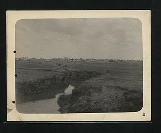
Molopo (river)
| Molopo | ||
|
The catchment area of the Molopo |
||
| Data | ||
| location |
southern Africa Botswana South Africa |
|
| River system | Orange | |
| Drain over | Orange → Atlantic Ocean | |
| origin | Quelltopf (Molopo Oog) between Groot Marico and Lichtenburg in South Africa 25 ° 53 ′ 8 ″ S , 26 ° 1 ′ 27 ″ E |
|
| Source height | 1472 m | |
| muzzle | near the Augrabies Falls in the Orange Coordinates: 28 ° 31 '2 " S , 20 ° 12' 46" E, 28 ° 31 '2 " S , 20 ° 12' 46" E |
|
| Mouth height | 446 m | |
| Height difference | 1026 m | |
| Bottom slope | approx. 1.1 ‰ | |
| length | approx. 960 km | |
| Catchment area | 367,201 km² | |
| Left tributaries | Madebe, Setlagole, Phepane, Kuruman | |
| Right tributaries | Ramatlabama , Molatswana, Nossob | |
| Medium-sized cities | Mahikeng | |
| Small towns | Molopo | |
|
Course of the Molopo near Mafikeng |
||
The Molopo is a rivier (temporarily water-bearing river ) in southern Africa .
River course
The river has a length of around 960 kilometers. Its source lies between the South African towns of Groot Marico and Lichtenburg . From there it flows almost towards the west. In the middle reaches the Molopot forms the border between South Africa and Botswana in large parts . It flows into the Orange River near the Augrabies Falls . The most important tributary is the Nossob , which flows in the lower reaches from the north . Another tributary is the Kuruman , known for its source, the Eye of Kuruman . In addition, in order of their confluence, are the Ramatlabama , Madebe, Setlagole, Molatswana and Phepane.
Catchment area
The catchment area is given with a size of 367,200 to 343,000 km² and extends to the countries Botswana (38%), Namibia (29%) and South Africa (33%). The river has only a slight gradient and therefore flows very slowly. Due to the low and rare rainfall, the Molopo has no surface drainage despite the pronounced river bed at the mouth. All water that leaves the catchment area to the Orange River flows as groundwater. There are no records of runoff below the pans in its lower reaches and the river bed is crossed by dunes. Therefore it is not assigned to the Orange catchment area in some publications.
Places on the Molopo
Riverside Molopo are among others in the upper reaches of the city mahikeng and the middle reaches of the place Molopo .
See also
Web links
Individual evidence
- ↑ a b c d e B. Richter: Groundwater Review of the Molopo-Nossob Basin for Rural Communities including Assessment of National Databases at the Sub-basin Level for Possible Future Integration. ( Memento of April 2, 2015 in the Internet Archive ) SADC Water Sector ICP Collaboration Portal, September 8, 2010 (summary and PDF file [19.52 MB])
- ↑ a b Key rivers of South Africa ( Memento from July 10, 2012 in the web archive archive.today ) in the online encyclopedia myfundi (accessed on July 8, 2012)
- ^ Feasibility Study of the Potential for Sustainable Water Resources Development in the Molopo-Nossob Watercourse

