Monsefú
| Monsefú | ||
|---|---|---|
|
|
||
| Coordinates | 6 ° 53 ′ S , 79 ° 52 ′ W | |
| Basic data | ||
| Country | Peru | |
| Lambayeque | ||
| province | Chiclayo | |
| ISO 3166-2 | PE-LAM | |
| District | Monsefú | |
| height | 11 m | |
| Residents | 23,969 (2017) | |
| founding | October 26, 1888 | |
| Website | munimonsefu.gob.pe (Spanish) | |
| politics | ||
| mayor | Manuel Pisfil Miñope (2019-2022) |
|
|
Plaza de Armas de Monsefú
|
||
Monsefú is a city in the province of Chiclayo in the Lambayeque region in northwestern Peru . Monsefú is the administrative seat of the district of the same name . At the 2017 census, the city had 23,969 inhabitants, 10 years earlier it had 22,165. Monsefú was raised to town by Simón Bolívar on October 26, 1888 .
Geographical location
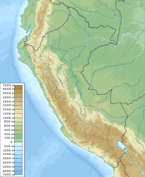
The city is located at an altitude of 11 m in the coastal plain of northwest Peru, 4 km from the Pacific coast. The city center of the regional capital Chiclayo is located 12 km north-northeast of Monsefú. The Río Chancay flows to the sea south of Monsefú . Irrigated agriculture is practiced in the vicinity of the city.
Individual evidence
- ↑ PERU: Lambayeque Region - Provinces & Places . www.citypopulation.de. Retrieved January 19, 2020.
Web links
Commons : Monsefú - collection of images, videos and audio files

