Monte Fasce
| Monte Fasce | ||
|---|---|---|
|
Eastern slope of Mount Fasce of Bogliasco seen from |
||
| height | 832 m slm | |
| location | Metropolitan city of Genoa , Italy | |
| Mountains | Ligurian Apennines | |
| Coordinates | 44 ° 24 '34 " N , 9 ° 2' 4" E | |
|
|
||
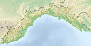
The Monte Fasce , also Monte Fascie , is a mountain near the Italian port city of Genoa . At 832 meters high, it is one of the highest peaks in the city's catchment area and has a decisive influence on the cityscape. It belongs to the mountain range of the Ligurian Apennines and forms the Parco Urbano di Monte Fasce e Monte Moro (in German: City Park Monte Fasce and Monte Moro ).
Monte Fasce rises north of the eastern quarters of Quarto dei Mille , Quinto and Nervi and shields them from the cool north winds. The summit is conical , similar to a volcano , and is about three kilometers from the Ligurian Sea .
At the summit there are numerous television and radio relay stations from public and private providers. A 14 meter high iron cross from 1900 stands on the highest point of Monte Fasce.
The nearby Prati di Fascia are a traditional destination for the Genoese. There the visitor a panorama opens up over the entire city, in favorable weather conditions the island of Corsica and the mountain ranges of the Apuan Alps , the Maritime Alps , the Valais Alps and the Lepontine Alps can be made out.
The Prati di Fascia can be reached via the SP 67 (del Monte Fasce) , which connects the Genoese residential area Apparizione with the village of Uscio . From there a road leads to the summit.

