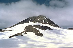
Mount Kialagvik
| Mount Kialagvik | ||
|---|---|---|
|
Mount Kialagvik |
||
| height | 1677 m | |
| location | Alaska (USA) | |
| Mountains | Aleutian chain | |
| Dominance | 16.2 km → Mount Chiginagak | |
| Notch height | 1127 m ↓ (550 m) | |
| Coordinates | 57 ° 12 '6 " N , 156 ° 44' 48" W | |
|
|
||
| Type | Stratovolcano | |
| Last eruption | not known | |
The Mount Kialagvik is a stratovolcano of the Aleutian Range , 590 km southwest of Anchorage .
The 1677 m high glaciated volcano is located 15.37 km east-northeast of the active volcano Mount Chiginagak . Mount Kialagvik has a central lava dome from the Holocene . Pyroclastic deposits were detected in the vicinity. On the southwest flank there are Andesitic lava flows and overlying Dazitic ash deposits. There are no known historical eruptions of the volcano.
The Kialagvik Creek drains the eastern flank to the nearby Wide Bay on the east coast of the Alaska Peninsula . The western flank forms the headwaters of the Dog Salmon River , which flows north to the Ugashik River .
Web links
Commons : Mount Kialagvik - collection of images, videos and audio files
- Kialagvik at Alaska Volcano Observatory (English)
- Kialagvik in the Global Volcanism Program of the Smithsonian Institution (English)
- Mount Kialagvik, Alaska on Peakbagger.com (English)
- Mount Kialagvik in the United States Geological Survey's Geographic Names Information System

