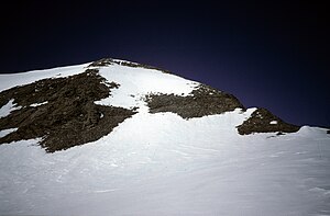
Mount Schimansky
| Mount Schimansky | ||
|---|---|---|
|
Mount Schimansky from the north |
||
| height | 2200 m | |
| location | Palmerland , Antarctic Peninsula | |
| Mountains | Welch Mountains | |
| Coordinates | 70 ° 50 ′ 9 ″ S , 63 ° 47 ′ 42 ″ W | |
|
|
||
| Normal way | Alpine tour (glaciated) | |
Mount Schimansky is a 2200 m high mountain in the shape of a ridge in Palmerland on the Antarctic Peninsula . It rises 10 km northwest of Heintz Peak in the Welch Mountains .
The United States Geological Survey mapped it in 1974. The Advisory Committee on Antarctic Names named it in 1976 after Lieutenant Commander John Albert Schimansky of the United States Navy , commander of a Lockheed C-130 Hercules for taking aerial photographs and determining the thickness of the ice on the Antarctic continent during Operation Deep Freeze in 1970 and 1971.
Web links
Commons : Mount Schimansky - collection of images, videos and audio files
- Mount Schimansky in the Geographic Names Information System of the United States Geological Survey (English)
- Mount Schimansky on geographic.org (English)

