Mount Washington, New Hampshire
| Mount Washington (Agiocochook) | ||
|---|---|---|
|
Mount Washington from Bretton Woods |
||
| height | 1917 m | |
| location | New Hampshire , USA | |
| Mountains | Presidential Range, Appalachian Mountains | |
| Coordinates | 44 ° 16 '14 " N , 71 ° 18' 12" W | |
|
|
||
| First ascent | 1642 by Darby Field | |
| Normal way | from Marshfield Station by rack railway to the summit | |
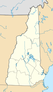
The mountain Mount Washington rises in the US state of New Hampshire and is part of the Presidential Range of the White Mountains in the Appalachians . At 1917 m , it is the highest point in the northeastern United States .
Weather and climate
At Mount Washington, which towers above the surrounding area by up to 1400 meters, and the other mountains of the Presidential Range, cold air from the north piles up and meets warm air from the south and west. That is why the summit of Mount Washington is climatically one of the most barren and windy areas on earth. Apart from tornadoes , the highest wind speed in the world up to 1996 was measured here at 372 km / h on April 12, 1934. In winter - often already in autumn, when it is still well above 0 ° C in the valley - temperatures of −40 ° C and below are measured. At more than 100 days a year reaches the wind speed at the top with over 120 km / h hurricane strength . An average wind speed of 56 km / h and an average temperature of −2.7 ° C create extreme wind chill effects.
ecology
Mount Washington includes several elevations . A northern deciduous forest grows in the valleys , which merges into a coniferous forest of spruce and fir trees at higher altitudes . The forest turns into Krummholz until the tree line is reached at an altitude of 1300 meters . The plants in the alpine zone above the tree line are adapted to the extreme climatic conditions.
history
The Indians called the mountain Agiocochook , "the home of the great spirit". Darby Field , a settler from Exeter , was the first white man to climb the mountain in 1642. His two Indian companions refused to climb the summit because the mountain was sacred to them. Fields company is in the records of the first governor of Massachusetts , John Winthrop , mentioned. In 1819 Abel Crawford and his son Ethan Allen Crawford , settlers and landlords in the valley named after them Crawford Notch , paved the first path to the summit. When the White Mountains were accessible by rail from the middle of the 19th century , the mountain was further developed for tourism. A bridle path was laid out on the summit, and the first tourist accommodation was built on the summit in 1852. Since the building was well attended, the Tip Top Hotel was built on the summit in 1853 . In 1861, a twelve-kilometer long carriage path, today's Mount Washington Auto Road, was completed. In 1869 the Mount Washington Cog Railway opened, a rack railway that is considered the oldest mountain railway in the world. A fire in 1908 destroyed all buildings on the summit with the exception of the Tip Top Hotel. Since 1932, the private Mount Washington Observatory at the summit has been operating year-round.
In January 1982, seventeen-year-old Hugh Herr lost both legs to frostbite in a snow storm on Mount Washington. The misfortune led him to become a bionic scientist and to research the development of artificial limbs.
Tourist facilities
The summit of Mount Washington is part of the 24-acre Mount Washington State Park . The mountain is located in the midst of the 3,000 square kilometers White Mountain National Forest . On the summit is the Sherman Adams Building , built in 1979 , a modern building named after Sherman Adams , a former New Hampshire governor . The building houses a visitor center, cafeteria, bathroom facilities, souvenir shops, the Mount Washington weather station, and a museum. The historic Tip Top Hotel is located right next to the modern buildings and can be visited from time to time.
The Mount Washington Auto Road, open from May to October, is a privately operated, toll road that leads from Gorham on the east side of the mountain over twelve kilometers with an average gradient of 12% over 1,441 meters in altitude to the summit. You can take minibuses or your own car to the top on the road.
The Mount Washington Cog Railway runs from Marshfield near Bretton Woods to the summit and back several times a day from April to November. At least 15 steep, long trails, including the Appalachian Trail , lead to the summit of Mount Washington.
Mount Washington Road Race is a 7.6 mile run that runs on the highway from the base of the mountain up to the summit. It was first held in 1936 and has been held annually since 1966. Along the same route, the Mount Washington Auto Road Bicycle Hillclimb has also been held since 1973, with Tyler Hamilton and Jeannie Longo among the most prominent winners .
See also
literature
- Günter Koch: The world's first cog railway on the summit - a train to Mount Washington . In: Lok-Magazin . No. 132 . Franckh'sche Verlagshandlung, W. Keller & Co. , 1985, ISSN 0458-1822 , p. 189-201 .


