
Mrzygłód
| Mrzygłód | |||
|---|---|---|---|

|
|
||
| Basic data | |||
| State : | Poland | ||
| Voivodeship : | Subcarpathian | ||
| Powiat : | Sanok | ||
| Gmina : | Sanok | ||
| Geographic location : | 49 ° 37 ′ N , 22 ° 16 ′ E | ||
| Residents : | 448 (2006) | ||
| Postal code : | 38-503 | ||
| Telephone code : | (+48) 13 | ||
| License plate : | RSA | ||
| Economy and Transport | |||
| Next international airport : | Rzeszów-Jasionka | ||

_Mrzyglod,_Tyrawa_am_San.JPG)
Mrzygłód ( Latin Tirafa Regalis ) is a village in the rural municipality of Sanok , Powiat Sanocki , Subcarpathian Voivodeship , in the extreme south-east of Poland .
geography
The place is near Tyrawa Solna north of Sanok, west of Tyrawa Wołoska, on the San in the Forest Carpathians , surrounded by the salt mountains of Sanok and the Dynower foothills. It is located in a wooded, hilly area on the county road between Sanok and Dobra. The average height above sea level is 300 m. Sanok is about 16 kilometers northwest and Przemyśl 60 kilometers east of Mrzygłód. Neighboring villages are Dębna in the south and Dobra in the north. District road 2220R runs north of the village square near Mrzygłód.
Education and Research
In Mrzygłód there is a primary school and a middle school ( gimnazjum in Polish ).
history
The first written mention of the place Tirawa comes from the year 1424, when Jogaila raised it to the city according to Magdeburg law . At that time, a church in honor of "the mission of the apostles" was founded in the middle of the village by King Jogaila . In 1616 it was already known as miasteczko Mrziglod ( the place where people starve to death ).
Since the Middle Ages, people have been making salt in the salt mountains. The salt trading privilege included the direct purchase on the saltworks and the sale on gradually all Ruthenian markets, it led to the wealth of the city and its citizens. In the following centuries, handicrafts developed, especially ceramics production.
In 1624 the town was destroyed by the Tatars.
Culture and sights
- St. Apostle Parish Church, built at the beginning of the 15th century
tourism
A hiking trail in the Beskid Subcarpathian region leads from Holzkirchen via Sanok to the village church of Bączal Dolny and on to Międzybrodzie –Mrzygłód – Ulucz – Dobra – Hołuczków back to Sanok.
![]()

St. Apostle Church of Mrzygłód (2014)
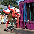
The reenactment of the Jogaila wedding of 1417 (2010)

Mrzyglod Fair (2014)


Web links
- Website about Mrzygłód (Polish)
Individual evidence
- ↑ Mrzygłód School (pl)
- ↑ Tomasz Jurek (editor): TYRAWA ( pl ) In: Słownik Historyczno-Geograficzny Ziem Polskich w Średniowieczu. Edycja elektroniczna . PAN . 2010-2016. Retrieved April 22, 2019.
- ↑ " Góry Słonne - na większości map iw przewodnikach: Słonne - zawdzięczają swoją nazwę źródłom solankowym, znajdującym się po ich północnej stronie" In: Wierchy: rocznik poóśrom. Edit. 35 p. 130. 1967
- ^ Sławomira Ciepiela. Wyroby rzemieślnicze w Polsce w XIV-XVIII wieku p. 33
- ↑ "niebieski"