
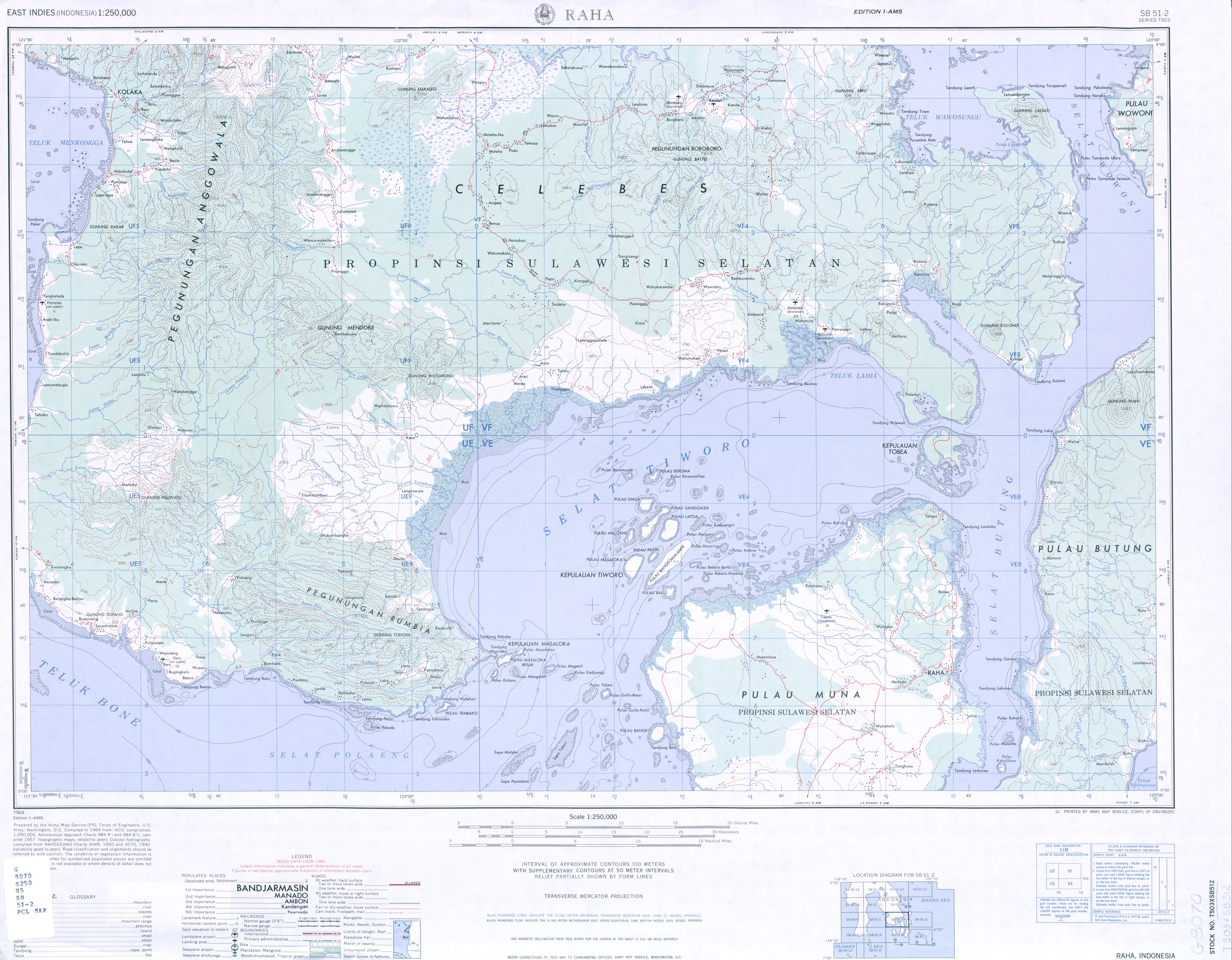
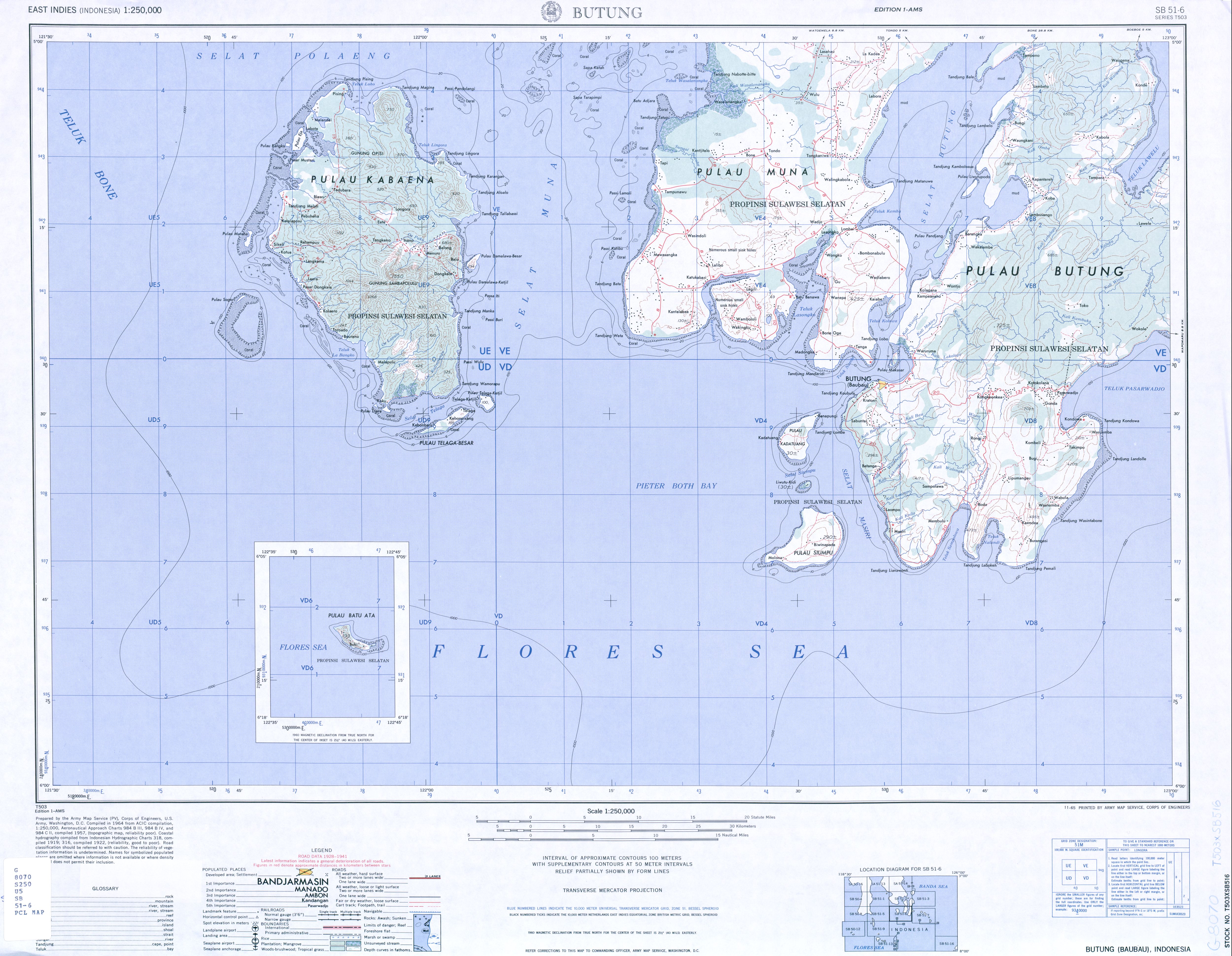
Muna (island)
| Muna | ||
|---|---|---|
 |
||
| Waters | Banda Lake | |
| Archipelago | Sulawesi | |
| Geographical location | 5 ° 0 ′ S , 122 ° 30 ′ E | |
|
||
| surface | 2 889 km² | |
| Highest elevation | 91 m | |
| main place | Raha | |

Muna is an island in Indonesia that belongs to the Sulawesi Tenggara province . Muna is located southeast of Sulawesi (separated by the Tiworo Strait), near Buton . The south of the island is part of the government district ( Kabupaten ) Buton , the northeast is the government district Muna , the northwest is Westmuna (Muna Barat), founded in 2014 .
The inhabitants of the heavily forested island make a living from agriculture and forestry. There are rice , spices , sago , sugar cane grown, along with fishing and processing plays a role of coconuts. The most important port is Raha on the northeast coast.
The 2889 km² island, in contrast to its mountainous neighboring island of Buton, only reaches a height of 91 m above sea level.
Muna-buton macaques ( Macaca ochreata brunnescens ), a subspecies of the gray-arm macaque , are native to the island .
Individual evidence
- ↑ UNEP Islands Directory (English)