Madura (island)
| Madura | |
|---|---|
| Topographic map of Madura | |
| Waters | Java lake , Bali lake |
| Archipelago | Great Sunda Islands |
| Geographical location | 7 ° 0 ′ S , 113 ° 25 ′ E |
| surface | 5 168 km² |
| Residents | 3,630,000 (2012) 702 inhabitants / km² |
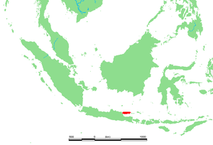
Madura is one of the Indonesian islands. The elongated island runs north along the eastern part of the Indonesian main island Java at the level of the port city of Surabaya .
Since June 2009 Madura has been connected to the island of Java via the Suramadu Bridge (Indon. Jembatan Suramadu ).
The area of the island is 4,428.9 km². About 3.630 million people live on it. The area of all 127 islands is 5,168 km². Muslims have made up the majority of the population since the 16th century .
The island is part of the Indonesian province of Jawa Timur (East Java). The most widely spoken language is Madurese , which is also used on many of the surrounding 126 islands. The two traditional industries are agriculture and fishing. Technologically, Madura is less developed than its larger neighboring island Java. Furthermore, Kretek cigarettes are produced on Madura . Salt is extracted in three large salt pans.
Among the special cultural events that take place in many villages in the summer months are bull races ( kerapan sapi ), in which a jockey drives two bulls over a distance of 80 to 130 meters. The bulls are brightly decorated at the event and presented to the music of gongs and the bowling oboe sarons . A culinary specialty, Soto Madura, a thick, hearty soup , also comes from this island .


