Mokil (atoll)
| Mokil | ||
|---|---|---|
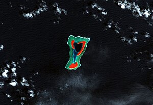
| Landsat false color image of Mokil | ||
| Waters | Pacific Ocean | |
| archipelago | Carolines | |
| Geographical location | 6 ° 41 ′ N , 159 ° 45 ′ E | |
|
|
||
| Number of islands | 3 | |
| Main island | Kahlap (Mokil) | |
| length | 4.5 km | |
| width | 2.8 km | |
| Land area | 1.24 km² | |
| Lagoon area | 2 km² | |
| total area | 6 km² | |
| Residents | 177 (2000) | |
| Map of Pohnpei, the Mokil atoll in the east | ||
Mokil (also Mwoakilloa , old names are Wellington or Duperrey Islands ) is an inhabited atoll in the central Pacific Ocean . Geographically it belongs to the Carolines Archipelago , politically to the federal state of Pohnpei of the Federated States of Micronesia .
Mokil is located in the east of Pohnpei, 153 km east of the island of Pohnpei and 113 km northwest of Pingelap . The nearly rectangular atoll is 4.5 km long and 2.8 km wide; the approximately 2 km² large lagoon is bordered by the three islands of Urak , Kahlap ( Mokil ) and Manton . Only Kahlap in the northeast is inhabited, with the village facing the lagoon. The land area of all islands together is 1.24 km².
The 177 residents Mokils speak Mokilesisch , one the Pohnpeanischen similar Micronesian language .
Web links
- Mokil on Oceandots ( Memento from December 23, 2010 in the Internet Archive )
- Mokil in the German Colonial Lexicon
- A map of Mokil
Individual evidence
- ↑ Pohnpei Census 2000 (English; PDF; 3.7 MB)


