
Narpes
| coat of arms | map |
|---|---|

|

|
| Basic data | |
| State : |
|
| Landscape : | Ostrobothnia |
| Administrative community : | South Ostrobothnia |
| Geographical location | 62 ° 28 ′ N , 21 ° 20 ′ E |
| Surface: | 2,334.17 km² |
| of which land area: | 977.16 km² |
| of which inland waterways: | 7.96 km² |
| of which sea area: | 1,349.05 km² |
| Residents : | 9,471 (December 31, 2018) |
| Population density : | 9.7 inhabitants / km² |
| Municipality number : | 545 |
| Language (s) : | Swedish , Finnish |
| Website : | www.narpes.fi |
Närpes ( Finnish Närpiö ) is a town and municipality in the western Finnish landscape Ostrobothnia . It is located around 80 kilometers south of the city of Vaasa on the coast of the Gulf of Bothnia . Until 2014, Närpes was one of three Finnish municipalities outside Åland in which only Swedish was the official language. The other two, Korsnäs and Larsmo , became bilingual in early 2015; Närpes only followed on January 1, 2016 because some residents had complained against the change in language status. About 93 percent of the population are Finland-Swedes .
Närpes was first mentioned in a document in 1331 and, as a parish, covered large parts of the surrounding area for centuries. The political municipality of Närpes has existed since 1867; In 1973 the previously independent municipalities Övermark and Pörtom and parts of the municipality of Korsnäs were merged into it. In 1993 Närpes received city rights. The politics of the municipality is determined by the Swedish People's Party , which will have 32 of the 35 members of the city parliament in the four-year period 2013–2016.
In addition to the parish village of Närpes, the town also includes Bäckby, Böle, Finnby, Gottböle, Kalax, Kaldnäs, Karlå, Klaresund, Knåpnäs, Kåtnäs, Norrnäs, Nämpnäs, Näsby, Pjelax, Rangsby, Ståbacka, Tjärytlax, Träskbötermark and Västerbötermark.
Närpes is a center of Finnish vegetable growing. In the greenhouses of the community around 60% of Finnish tomatoes and a third of Finnish cucumbers are drawn. Traditionally, boat building and fishing are also of great importance, and wood and metal processing industries have settled here.
The parish church of Närpes is worth seeing. It dates from the middle of the 16th century and has been expanded and redesigned many times since then. There are around 150 stables in the churchyard where churchgoers parked their horses for the duration of the service. The wooden churches of Pörtom and Övermark date from the years 1781–1783 and 1878, respectively. The Öjskogsparken amusement park , which houses a theater, a petting zoo and various museums, is still important for tourism .
Town twinning

The church of Narpes

Church stables
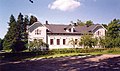
Rectory


Web links
swell
- ↑ Maanmittauslaitos (Finnish land surveying office): Suomen pinta-alat kunnittain January 1, 2010 (PDF; 199 kB)
- ↑ Statistical Office Finland: Table 11ra - Key figures on population by region, 1990-2018
- ↑ Now Närpes is like other municipalities (Swedish)
- ↑ Närpes City Council ( Memento of the original from January 9, 2016 in the Internet Archive ) Info: The archive link was inserted automatically and has not yet been checked. Please check the original and archive link according to the instructions and then remove this notice. (Swedish)