
Narooma
| Narooma | |||||||
|---|---|---|---|---|---|---|---|
 Bridge at Narooma on the Princes Highway |
|||||||
|
|||||||
|
|||||||
|
|||||||
|
|||||||
|
|||||||

Narooma is a small town in the southeast of the Australian state of New South Wales . It is located on the Eurobodalla coast about 340 km south of Sydney and about 130 km southeast of Canberra , on the Princes Highway . The name is derived from a word in the Aboriginal language that means "clear blue water". The 2016 census counted 3,342 residents.
The Montague Island , a state nature reserve, located in Narooma 8 km from the coast. It is said that Captain Cook gave the island its name while sailing north along the New South Wales coastline, but that is incorrect. He gave Mount Dromedary - located inland from Narooma - his name, but his ship, the HMB Endeavor , was then on an east course and passed the island far east. From this position, the island appeared as a promontory protruding from the coast, so Cook named it Cape Dromedary because it appeared to be below the mountain. Later, in 1790, the crew of one of the infamous Second Fleet ships stated that this was an island, and it was named Montagu (after George Montagu Dunk, Earl of Halifax ), although no one knows by whom. Bass and Flinders confirmed on their voyages of discovery in the late 1790s that it was indeed an island.
The historic place Central Tilba is located south of it.
history
In the vicinity of the later city, in Punkalla - today part of Bodalla - there was an earlier settlement, where you can still see Nerrigundah , a dilapidated sawmill with a loading quay. In 1880 gold was found nearby, in Tilba , and a post office was opened in Corunna , which was renamed Narooma in 1892 . There is still Corunna Street in Narooma today .
The settlement of Narooma was elevated to a city in 1883 and measured. In 1884 it was given the title of port city. A school opened in 1886 and a post office followed in 1889.
At first, Narooma could only be reached by sea. From 1894 there was a rowboat as a ferry across the Wagonga Inlet , which connected Narooma with Moruya . A daily stagecoach from Bega to Moruya also drove through the city.
Narooma has been a popular destination for tourists since the beginning of the 20th century. An oyster farm was established in 1900. The Uniting (formerly Methodist ) Church on Princes Highway dates from 1914. Together with its rectory, it is an excellent example of the neo-Gothic architectural style in Australia.
From 1929 a petrol-powered ferry was used, which previously drove in Batemans Bay . The road bridge in Narooma was the first major bridge that the then Main Roads Board had built for the new Princes Highway. It was built between 1929 and 1931 and spans the Wagonga Inlet . The steel and concrete bridge has three sections. It is one of only two bascule bridges remaining in New South Wales in 2002 . The other was due to be demolished this year. A footpath was built in 1960 on the side of the bridge facing the sea.
A fish canning factory opened in 1937 or 1940 processing tuna and salmon. The salmon that came into the bay each year was caught and processed. It is said that during one of the annual visits to the schools of salmon, a worker left a trap door open to allow a small number of fish to escape. In the following years the schools of salmon never returned to the bay and the canning factory had to close.

Narooma Courthouse

The Uniting Church from 1914

The rectory of the Uniting Church

Australia rock


geology
Narooma is located on the Narooma Terran , which was formed many thousands of kilometers from the Australian coast. Due to the continental drift, it drifted west and laid itself against the Lachlan fold belt, which became part of Australia. The rock from the Narooma area also contains the Cambrian Narooma chert and turbidite . You can also find remains of an underwater volcano with pillow lava .
climate
| NAROOMA - Height: 0 m | ||||||||||||||||||||||||||||||||||||||||||||||||
|---|---|---|---|---|---|---|---|---|---|---|---|---|---|---|---|---|---|---|---|---|---|---|---|---|---|---|---|---|---|---|---|---|---|---|---|---|---|---|---|---|---|---|---|---|---|---|---|---|
| Climate diagram | ||||||||||||||||||||||||||||||||||||||||||||||||
| ||||||||||||||||||||||||||||||||||||||||||||||||
|
Average monthly temperatures and precipitation for NAROOMA - Altitude: 0 m
Source:
|
|||||||||||||||||||||||||||||||||||||||||||||||||||||||||||||||||||||||||||
Sights and things to do
We recommend a guided tour from Narooma on and around Montague Island.
The mount gulaga which - by Captain Cook because of its resemblance to a camel Mount Dormedary called - can from the settlement Tilba be climbed from. There are eight types of rainforest on the slopes of this mountain, as well as rocks of great importance to the native Aborigines. The view from the mountain top is limited by the vegetation.
Beaches in the area are Dalmeny Beach , Narooma Beach , Bar Beach (with shallow water) and Yabarra Beach .
Australia Rock is found at the bay's barrier to the open sea. The outlines of Australia on the rock came about by chance and were formed many years ago when a ship was chained to the rock in rough seas to prevent it from being driven off.
The Narooma Golf Course opened in 1930 and is one of Australia's 50 most beautiful public golf courses and one of Australia's 25 most beautiful club-owned golf courses. The golf course is said to be spectacular and challenging. From there you can see Montague Island in the east and the '' Glass House Rocks '' in the south.
The Great Southern Blues and Rockabilly Festival was held annually on the long weekend in October until it was relocated to Batemans Bay in 2010.
Gallery images
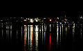
Narooma by night. View over Wagonga Inlet.

Australia Rock looks out to sea

The city of Narooma from Australia Rock


Web links
Individual evidence
- ↑ a b Australian Bureau of Statistics : Narooma ( English ) In: 2016 Census QuickStats . June 27, 2017. Retrieved February 7, 2016.
- ↑ Laurelle Pacey: The Lure of Montague
- ↑ a b c d Narooma . In: Walkabout . John Fairfax. Archived from the original on March 23, 2006. Info: The archive link was inserted automatically and has not yet been checked. Please check the original and archive link according to the instructions and then remove this notice. Retrieved January 30, 2006.
- ↑ a b Narooma Bridge . In: Heritage and conservation register . Roads and Traffic Authority of New South Wales. 2002. Retrieved January 30, 2006.
- ↑ Victoria Creek Bridge , Roads and Traffic Authority (NSW), March 30, 2004.
- ^ Maritime heritage online - South east , Heritage Office NSW, 2001.
- ^ Climate Statistics for Narooma, New South Wales . Bureau of Meteorology. Retrieved May 12, 2012.
- ↑ Narooma Golf Course . In: The Great Outdoors . au.travel.yahoo.com. December 2004. Retrieved April 13, 2008.
- ↑ Bluesfestival.tv