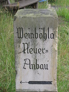
New extension
|
New extension
Weinböhla municipality
Coordinates: 51 ° 10 ′ 30 ″ N , 13 ° 37 ′ 0 ″ E
|
|
|---|---|
| Height : | 180 m above sea level NN |
| Incorporation : | 1936 |
| Postal code : | 01689 |
| Area code : | 035243 |
The new extension is a district of Weinböhla in the district of Meißen , Saxony .
geography
The district of Neuer Cultivation is located in the northeast of the Weinböhla municipality. It is located about four kilometers northeast of the town center in the Weinböhla district and is completely surrounded by Friedewald , a nature reserve . Neighboring to the north is the Moritzburg district of Steinbach , to the east several Moritzburg ponds and southeast of the district of Auer, which also belongs to Moritzburg . To the south lies the forester's house Kreyern , which lies in the Coswig area.
State road 81 runs through the district from Großenhain to Dresden-Klotzsche . In a north-westerly direction it leads to the Buschhaus near Großdobritz , to the south-east over the Auer to Friedewald . In the Neuer Extension district, a road branches off via the Heidehof clinic to Steinbach. The district itself is located on the “New Cultivation” road, which goes under the name “Waldweg” to Weinböhla. The regional traffic Dresden stops with a bus line in the district.
history

The village of Krauschen was initially located on the site of the present part of the new building. It was first mentioned in 1350 as "villa Cruschin". The place name is most closely related to the Old Sorbian word "Krušina", which means the buckthorn . As early as 1378, however, five hooves were recorded "in the desert village of Kruchschin". At that time Krauschen was therefore a desert , also in 1435, when the names "Crussin" and "zu Kruschen in dem vusten dorff" appear. In 1465 the place appears as "Kruwschen", in 1539 the Reichenberg church received the tithe "vom village Krausch". Around 1600 the cartographer Matthias Oeder recorded the artificially dammed “Krauschenteich” on one of his maps. In the period that followed, the place name, which was no longer understood, was based on the name of the fish crucian carp . After the pond was drained, the “Karauschenwiese” mentioned in 1795 emerged.
Around 1800, the desolate fields on the Karauschenwiese were repopulated. The resulting village was given the name "New Annex" mentioned in 1816 and 1875, among other things. At times, the name was based on the country Municipal Code of 1838 formed rural community also "Kleinnaunhof". This designation made a reference to the present Ebersbacher district Naunhof forth from the manor from the 16th century manorial was exercised over the crucian carp meadow. After Naunhof, the village was also a parish. The village was initially administered by the Hayn Office before it came to the newly formed Moritzburg Office in the 19th century . The partly row-like house settlement had a parcel corridor which in 1900 comprised six hectares. In 1908, in addition to the place name "New Annex", the name "Karauschenhaus" was also in use. The forest north of the village is still called “Karauschenholz” today. It was incorporated into Weinböhla in 1936. The village, which had been part of the Großenhain administration since 1874, became part of the Meißen administration and has shared the history of Weinböhla ever since. The exclusively Evangelical Lutheran residents of the village had belonged to the Weinböhla parish as early as 1930.
Population development
|
Web links
- New extension in the digital historical directory of Saxony
- Krauschen desert in the digital historical directory of Saxony


