Newala (district)
| Newala District
|
||
|---|---|---|
| Basic data | ||
| Country | Tanzania | |
| region | Mtwara | |
| surface | 2126 km² | |
| Residents | 205,492 (2012) | |
| density | 97 inhabitants per km² | |
| ISO 3166-2 | TZ-17 | |
Coordinates: 10 ° 42 ′ S , 38 ° 59 ′ E
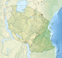
Newala is a district in the Tanzanian region of Mtwara with the administrative center in the city of Newala . It borders on the Lindi region to the north, the Tandahimba district to the east, Mozambique to the south and the Masasi district to the west and northwest .
geography
Newala has an area of 2126 square kilometers and 205,492 inhabitants (as of 2012). The land lies at an altitude of 900 meters above sea level on the Makonde plateau , which slopes steeply to the north, west and south. The southern border is the Rovumo River . The climate is tropical, Aw according to the effective climate classification . The country has two seasons. The rainy season lasts from November to May and a cooler dry season from June to October. Every year, an average of 1,000 millimeters of rain falls with an average temperature of 23 degrees Celsius.
history
Newala is a district that was established in 1954 during the British colonial era. With independence, the district was taken over, but abandoned in 1972 in the course of decentralization and assigned to the Madaraka Mikoani area. After ten years the district was restored.
Administrative division
The district consists of the four divisions Chilangala, Kitangali, Mchemo and Mkwedu and 28 parishes (wards):
- Luchingu
- Makote
- Nanguruwe
- Mkunya
- Mcholi I
- Namiyonga
- Mnekachi
- Chitekete
- Mnyambe
- Chilangalanga
- Mkoma II
- Kitangari
- Malatu
- Mchemo
- Mtopwa
- Chiwonga
- Maputi
- Makukwe
- Mkwedu
- Mcholi II
- Mtonya
- Makonga
- Nakahako
- Chihangu
- Nambali
- Nandwahi
- Mtunguru
- Mdimbampelempele
populationMainly Makonde live in the district . The population rose from 183,344 in 2002 to 205,492 in 2012. This corresponds to an annual growth of 1.1 percent. Of those over five, 62 percent spoke Swahili, 6 percent English and Swahili, and 32 percent were illiterate. |
 |
Facilities and services
- Education: There are 74 primary schools in the district, with 61 students per teacher. The primary schools are all state-run. Of the 16 secondary schools, 15 are state-run and one is private. Of the 296 teachers required in public schools, 115 are missing (as of 2017).
- Health: There are three health centers and 22 pharmacies in the district for medical care for the population (as of 2019).
- Water: In 2012 only 37 percent of the population had access to safe and clean water, more than half used rainwater.
Economy and Infrastructure
|
The main economic activity in the district is agriculture. It employs more than 87 percent of the population and contributes 47 percent to the gross domestic product .
|
 |
Others
From 2001 to 2018, the forested area in the district decreased by 28 percent. While more than a third of the area was forested in 2000, there was no healthy forest in the district in 2016.
Web links
Individual evidence
- ↑ Ukubwa wa eneo | Newala District Council. Accessed February 16, 2020 .
- ^ A b Tanzania Regional Profiles, 09. Mtwara Regional Profile. (PDF) The United Republic of Tanzania, pp. 15, 71 , accessed on February 15, 2020 .
- ↑ ? Tanzania map. Accessed February 16, 2020 .
- ↑ a b Strategic Plan 1017/18 - 2021/22. (PDF) Newala District Council, December 2017, p. 5 , accessed on February 16, 2020 .
- ↑ Newala climate: Average Temperature, weather by month, Newala weather averages - Climate-Data.org. Accessed February 16, 2020 .
- ↑ Chimbuko | Newala District Council. Accessed February 16, 2020 .
- ↑ 2012 Population and Housing Census. (PDF) National Bureau of Statistics and Ministry of Finance, March 2013, p. 89 , accessed on February 15, 2020 .
- ↑ Watu wa eneo husika | Newala District Council. Accessed February 16, 2020 .
- ↑ Strategic Plan 1017/18 - 2021/22. (PDF) Newala District Council, December 2017, pp. 24, 27 , accessed on February 16, 2020 .
- ↑ Statistics | Newala District Council. Accessed February 16, 2020 .
- ↑ Strategic Plan 1017/18 - 2021/22. (PDF) Newala District Council, December 2017, p. 16 , accessed on February 16, 2020 .
- ↑ Shughuli za kiuchumi | Newala District Council. Accessed February 16, 2020 .
- ↑ a b Strategic Plan 1017/18 - 2021/22. (PDF) Newala District Council, December 2017, p. 15 , accessed on February 16, 2020 .
- ↑ Tanzania Regional Profiles, 09. Mtwara Regional Profile. (PDF) The United Republic of Tanzania, pp. 125, 131 , accessed on February 15, 2020 .
- ↑ Newala. Retrieved February 16, 2020 (de-US).
- ^ Trunk Roads Network. Accessed February 16, 2020 .
- ↑ World Resources Institute: Newala, Mtwara, Tanzania | Dashboards | Global Forest Watch. Accessed February 16, 2020 .
