
Nibok
| Location of Niboks | |
|---|---|
  |
|
| surface | |
| Rank (within Naurus) | 4 (of 14) |
| All in all | 1.6 km² |
| country | 1.6 km² |
| Water (%) | 0 |
| Residents | |
| Rank (within Naurus) | 9 (of 14) |
| Total status (2011) | 484 |
| density | 303 inhabitants / km² |
| geography | |
| Time zone | UTC +12 |
| Geographical location | 0 ° 31 '18 " S , 166 ° 55' 12" O |
| Highest position | approx. 50 m |
| Average location | approx. 20 m |
| Lowest position | approx. 0 m |

|
|
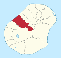
Nibok [ ˈniːbœk ] is a district of the island state of Nauru , in the west of the island . It is 1.6 km² and has 484 inhabitants. It borders Denigomodu to the west, Buada to the south, Anibare to the southeast and Uaboe to the northeast . Nibok is home to the NPC's phosphate field works, as well as a chapel and a preschool (Nibok Infant) . Nibok is part of the Ubenide constituency .

Individual evidence
- ↑ Table 1: Population size and growth rate by district. ( Memento of the original from September 24, 2015 in the Internet Archive ) Info: The archive link was inserted automatically and has not yet been checked. Please check the original and archive link according to the instructions and then remove this notice. In: Republic of Nauru. Census 2011. National Report on Population and Housing. Secretariat of the Pacific Community, p. 8. Retrieved July 15, 2015.