
Anabar (District)
| Location of Anabars | |
|---|---|
  |
|
| surface | |
| Rank (within Naurus) | 5 (of 14) |
| All in all | 1.5 km² |
| Residents | |
| Rank (within Naurus) | 10 (of 14) |
| Total status (2011) | 452 |
| density | 301 inhabitants / km² |
| geography | |
| Time zone | UTC +12 |
| Geographical location | 0 ° 31 ′ 0 ″ S , 166 ° 57 ′ 0 ″ E |
| width | approx. 0.1-1.2 km |
| length | approx. 0.1-1.4 km |
| Highest position | approx. 40 m |
| Average location | approx. 25 m |
| Lowest position | approx. 0 m |
| politics | |
| MPs |
Riddell Akua Ludwig Scotty |

|
|
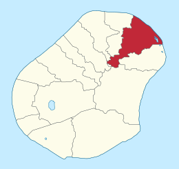
Anabar is a district of the island state of Nauru , in the northeast of the island. It borders on Ewa and Baiti in the southwest, Anetan in the west, Ijuw in the southeast and Anibare in the south. It is 1.5 km² and has 452 inhabitants. There is a Protestant chapel. Anabar is part of the Anabar constituency of the same name .
Anabar takes its name from the village of the same name, Anabar ; according to Paul Hambruch it means “little earth” or “hard as stone”, which is due to the little fertile coastal zone there.
Historic villages
Until 1968 , today's Anabar district was a district , which consisted of 15 historical villages.
- Adibor
- Aeibur
- Anabar
- Araro
- Areb
- Atebar
- Atibuyinor
- Atowong
- Bagetareor
- Bodeadi
- Eaterieri
- Imweteyung
- Wereda
- Yaterangia
- Yuwinengin
Personalities
- Ludwig Scotty (* 1948), politician and two-time President Naurus
Individual evidence
- ↑ Table 1: Population size and growth rate by district. ( Memento from September 24, 2015 in the Internet Archive ) In: Republic of Nauru. Census 2011. National Report on Population and Housing. Secretariat of the Pacific Community, p. 8. Retrieved July 15, 2015.