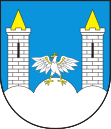
Niegowa
| Niegowa | ||
|---|---|---|

|
|
|
| Basic data | ||
| State : | Poland | |
| Voivodeship : | Silesia | |
| Powiat : | Myszków | |
| Geographic location : | 50 ° 39 ′ N , 19 ° 29 ′ E | |
| Residents : | 740 | |
| Postal code : | 42-320 | |
| Telephone code : | (+48) 34 | |
| License plate : | SMY | |
| Economy and Transport | ||
| Street : | Ext. 789 | |
| Next international airport : | Katowice | |
| Gmina | ||
| Gminatype: | Rural community | |
| Gmina structure: | 20 school offices | |
| Surface: | 87.57 km² | |
| Residents: | 5642 (June 30, 2019) |
|
| Population density : | 64 inhabitants / km² | |
| Community number ( GUS ): | 2409032 | |
| Administration (as of 2007) | ||
| Community leader : | Krzysztof Adam Motyl | |
| Address: | ul.Sobieskiego 1 42-320 Niegowa |
|
| Website : | www.niegowa.pl | |
Niegowa [ ɲɛ'gɔva ] is a village in powiat Myszkowski in the Silesian Voivodeship , Poland . It is the seat of the rural community of the same name .
geography
Niegowa is located 33 km southeast of Częstochowa in the hill country between Częstochowa and Krakow .
history
From 1975 to 1998 Niegowa belonged to the Częstochowa Voivodeship .
local community
The municipality extends over an area of 87.57 km² of which 78% are used for agriculture and 14% are forested.
For rural community (gmina wiejska) Niegowa include the 20 Sołectwa (Schulz offices) Antolka , Bliżyce , Bobolice , Brzeziny , Dabrówno , Gorzków Novy , Gorzków Stary , Ludwinow , Łutowiec , Mirów , Moczydlo , Mzurów , Niegowa, Niegówka , Ogorzelnik , Postaszowice , Sokolniki , Tomiszowice , Trzebniów and Zagórze .
traffic
The provincial road 789 ( droga wojewódzka 789 ) runs through the village .
Web links
- Municipality website (Polish)
Individual evidence
- ↑ population. Size and Structure by Territorial Division. As of June 30, 2019. Główny Urząd Statystyczny (GUS) (PDF files; 0.99 MiB), accessed December 24, 2019 .
- ↑ Dz.U. 1975 no 17 poz. 92 ( Memento from April 8, 2009 on WebCite ) (Polish)
- ↑ regioset.pl (Polish)
