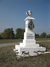
Nihyn
| Nihyn | ||
| Нігин | ||

|
|
|
| Basic data | ||
|---|---|---|
| Oblast : | Khmelnytskyi Oblast | |
| Rajon : | Kamianets-Podilskyi district | |
| Height : | 246 m | |
| Area : | 2.45 km² | |
| Residents : | 1,275 (2001) | |
| Population density : | 520 inhabitants per km² | |
| Postcodes : | 32320 | |
| Area code : | +380 3849 | |
| Geographic location : | 48 ° 50 ' N , 26 ° 34' E | |
| KOATUU : | 6822485401 | |
| Administrative structure : | 1 village | |
| Address: | площа Підгородецького буд. 1 32320 с. Нігин |
|
| Website : | City council website | |
| Statistical information | ||
|
|
||
Nihyn ( Ukrainian Нігин ; Russian Негин Negin , Polish Nihyn ) is a village in the south of the Ukrainian Oblast Khmelnyzkyj with about 1200 inhabitants (2010).
The village, first mentioned in writing in 1530, belongs administratively to the rural community of Humenzi in the north of Kamyanets -Podilskyj district .
The village is located in the Podiler Towtry National Park ( Національний природний парк “Подільські Товтри” ) at an altitude of 246 m near the left bank of the Smotrych , 12 km northwest of the community center of Humenzi, 17 km north-west of the center of the Podilsky district of Humenzi, and 75 km north of the center of Podilsky Oblastian district Khmelnytskyi .
The T-23-21 territorial road runs through the village . It has a train station on the Khmelnytskyi – Kelmentsi railway line .
Web links
- Nihin . In: Filip Sulimierski, Władysław Walewski (eds.): Słownik geograficzny Królestwa Polskiego i innych krajów słowiańskich . tape 7 : Netrebka – Perepiat . Walewskiego, Warsaw 1886, p. 146 (Polish, edu.pl ).
Individual evidence
- ↑ website of the municipal council on rada.info ; accessed on March 28, 2020 (Ukrainian)
- ↑ a b local website on the official website of the Verkhovna Rada ; accessed on March 28, 2020 (Ukrainian)
- ↑ history Nihyn in the history of the towns and villages of the Ukrainian SSR ; accessed on March 28, 2020 (Ukrainian)


