Nizina Sępopolska
| Nizina Sępopolska
Schippenbeiler lowlands, Schippenbeiler basin
|
|
|---|---|
|
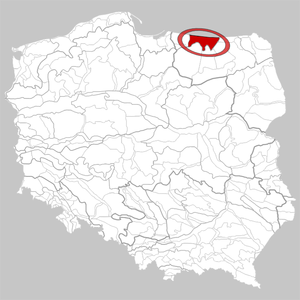
Location of Nizina Sępopolska in Poland |
|
|
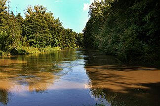
River Łyna (Alle) near Bartoszyce (Bartenstein) |
|
| location | Warmia-Masuria , Poland |
| Coordinates | 54 ° 16 ′ N , 21 ° 1 ′ E |


The Nizina Sępopolska (German Schippenbeiler Tiefland or Schippenbeiler basin or Schippenbeiler Bucht ) is a mesoregion in the Warmian-Masurian Voivodeship in Poland . It is about 1160 km². The area is shaped by the Ice Age with numerous moraines and lakes.
location
The Nizina Sępopolska is part of the Nizina Staropruska . In the north it borders on the Pregel Valley in the Russian exclave Kaliningrad , in the east on the Great Masurian Lakes and the Angerapper Land , in the south on the Allenstein Lake District and the Sensburger Lake District and in the west on the Stablack .
Lakes
The largest lakes in the region are:
Rivers
The Nizina Sępopolska drains into the Pregel . Significant rivers are:
colonization
The Nizina Sępopolska is relatively sparsely populated. Most important small towns are:
- the eponymous Sępopol (shovel ax)
- Kętrzyn (Rastenburg)
- Korsze (Korschen)
- Bartoszyce (Bartenstein)
literature
- Jerzy Kondracki: Geografia regionalna Polski. Warszawa 2002, PWN, ISBN 83-01-13897-1 .
Web links
Individual evidence
- ^ Manfred Niemeyer (ed.): German book of place names. De Gruyter, Berlin / Boston 2012, p. 50, entry Bartenstein / Bartoszyce .
- ↑ Theodor Hurtig : The Spirdingsee area and the Schippenbeiler basin. In: Writings of the Physikalisch-Ökonomische Gesellschaft zu Königsberg , Volume 68 (1935), Issue 3/4, pp. 217-252.
- ↑ Bernhard Körnke: Geological studies on the hydrographic development in northern East Prussia with special consideration of the diluvial main valley (Inster-Pregel valley range). In: Treatises of the Prussian Geological State Institute , New Series, Issue 127 (1930), pp. 18-19.

