North Fork Payette River
| North Fork Payette River | ||
|
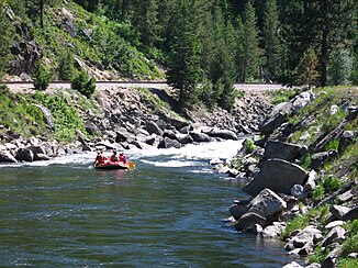
North Fork Payette River near Banks |
||
| Data | ||
| Water code | US : 387749 | |
| location | Boise County , Valley County in Idaho (USA) | |
| River system | Columbia River | |
| Drain over | Payette River → Snake River → Columbia River → Pacific Ocean | |
| Headwaters |
Salmon River Mountains 45 ° 10 ′ 43 " N , 115 ° 59 ′ 34" W. |
|
| Source height | approx. 1850 m | |
| Association with |
South Fork Payette River to Payette River Coordinates: 44 ° 5 '4 " N , 116 ° 6' 55" W 44 ° 5 '4 " N , 116 ° 6' 55" W. |
|
| Mouth height | 861 m | |
| Height difference | approx. 989 m | |
| Bottom slope | approx. 5.4 ‰ | |
| length | 182 km | |
| Catchment area | 2384 km² | |
| Discharge at the Banks A Eo gauge : 2384 km² Location: 5 km above the estuary |
MQ 1948/2016 Mq 1948/2016 |
36 m³ / s 15.1 l / (s km²) |
| Left tributaries | Lake Fork Payette River, Gold Fork Payette River, Clear Creek | |
| Flowing lakes | Upper Payette Lake, Payette Lake | |
| Reservoirs flowed through | Lake Cascade | |
| Communities | Cascade , McCall | |
|
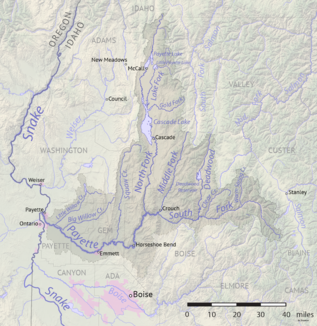
North Fork Payette River in the Payette River basin |
||
|
Cascade Dam and Lake Cascade |
||
The North Fork Payette River is the right-hand headwaters of the Payette River in the east of the US state Idaho .
The river has its source in the Salmon River Mountains . It flows consistently in a southerly direction. Upper Payette Lake is located on the upper reaches . Later, the North Fork Payette River flows through Payette Lake , on the south bank of which is the village of McCall . The river then crosses the 80 km long Long Valley , a 440 m high basin enclosed by mountain ranges. At the southern end of the high valley, the river at Cascade is dammed from Cascade Dam to Lake Cascade, which is 122 km² in size . In the lower reaches of the North Fork Payette River cuts through the mountains over a distance of 40 km. This stretch of the river is popular with whitewater canoeists and kayakers. The Idaho State Highway 55 follows from McCall the course of the river to the junction with the South Fork Payette River near Banks . The 182 km long North Fork Payette River drains an area of 2384 km². The mean discharge of the North Fork Payette River is 36 m³ / s. June is the month with the highest drainage.


