Payette River
| Payette River | ||
|
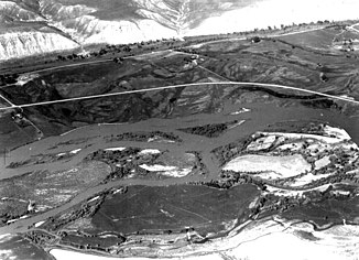
Lower Payette River |
||
| Data | ||
| Water code | US : 388284 | |
| location | Payette County , Gem County , Boise County , Idaho (USA) | |
| River system | Columbia River | |
| Drain over | Snake River → Columbia River → Pacific Ocean | |
| Confluence of |
North Fork and South Fork Payette River 44 ° 5 ′ 4 " N , 116 ° 6 ′ 54" W |
|
| Source height | 855 m | |
| muzzle |
Snake River Coordinates: 44 ° 5 '32 " N , 116 ° 57' 9" W 44 ° 5 '32 " N , 116 ° 57' 9" W. |
|
| Mouth height | 648 m | |
| Height difference | 207 m | |
| Bottom slope | 1.5 ‰ | |
| length | 134 km | |
| Catchment area | 8392 km² | |
| Discharge at the gauge near Payette A Eo : 8388 km² Location: 6 km above the mouth |
MQ 1936/2016 Mq 1936/2016 |
83 m³ / s 9.9 l / (s km²) |
| Right tributaries | Squaw Creek, Big Willow Creek, Little Willow Creek | |
| Reservoirs flowed through | Black Canyon Reservoir | |
| Small towns | Emmett , Payette | |
| Communities | Horseshoe Bend | |
|
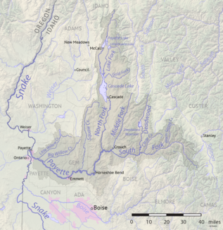
Course of the river and catchment area of the Payette River |
||
The Payette River is a right tributary of the Snake River in the east of the US state Idaho .
The river arises at the confluence of its two headwaters, North Fork and South Fork Payette River , on the western edge of the Rocky Mountains . At first it still flows through the mountains. He passes the village of Horseshoe Bend . It is then dammed below the confluence of Squaw Creek to the Black Canyon Reservoir . An irrigation canal branches off to the left and right of the dam. The lower reaches of the Payette River runs through the Snake River Plain , an arid plain. The river passes the small town of Emmett and turns to the northwest. The area along the river below the Black Canyon Dam is used for agriculture by means of irrigation . The Payette River finally flows into the Snake River at Payette , 75 km northwest of Boise .
The Payette River has a length of 134 km. It drains an area of 8392 km². The mean discharge at the mouth is 83 m³ / s. The highest monthly outflows occur there in May and June.
The river was named after François Payette , a fur trader for the North West Company .
Hydrometry
measured from 1936–2016


