Notkersegg
| Notkersegg | |
|---|---|
| State : |
|
| Canton : |
|
| Constituency : | St. Gallen |
| Political community : | St. Gallen |
| Postal code : | 9011 |
| former BFS no. : | 3203035 |
| Coordinates : | 748 191 / 254607 |
| map | |
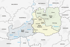
Notkersegg is a district in the Swiss city of St. Gallen .
location
Notkersegg is located in the south of the city on the northern slope of the Freudenberg and is connected to the rest of St. Gallen by the Trogenerbahn through the “Notkersegg” and “Schwarzer Bären” stations. The rural district begins just east of the Drei Weieren in the west and borders the canton of Appenzell Ausserrhoden in the east . In the south the district borders on St. Georgen , in the north on St. Fiden / Neudorf. The only area of denser settlement is in the west of the neighborhood north of Speicherstrasse, opposite the Notkersegg monastery, which gives it its name .
In April 2014, 555 people lived in the quarter, 88% of whom were Swiss and 12% foreigners, which was the lowest proportion of foreigners in the city. The proportion of the over 65s was the highest in the city at 23%, while the proportion of the working-age population was the lowest in St. Gallen at 58%. Notkersegg is the district with the lowest population in St. Gallen.
Apart from the residential buildings, the Notkersegg district has no remarkable infrastructure. The quarter has neither schools nor shops and there are no restaurants in the main settlement area. The restaurants in the neighborhood are places to visit that are some distance from the settlement area, which can be explained by the history of the neighborhood.


history
Until the municipal consolidation in 1918, the Notkersegg district belonged to the Tablat municipality and consisted almost exclusively of agricultural and forestry areas. The housing estate is located in the Wiesen area for the most part on Hardungstrasse, which was laid out as a ring road and was built between 1961 and 1983 on the basis of a development plan approved in 1960. Since then only a few houses have been built. The structure of the settlement largely corresponds to a 1913 officially approved plan by local entrepreneur Anton Egger for a garden city that was inspired by Ebenezer Howard's ideas. Because of the outbreak of war and the embroidery crisis, Egger went bankrupt in 1914. The project failed and was only implemented according to the original specifications 50 years later.
Web links
Individual evidence
- ↑ https://www.stadt.sg.ch/home/gesellschaft-sicherheit/z togetherleben- vereine/quartiervereine/quartierentwicklung/_jcr_content/Par/downloadlist/DownloadListPar/download_0.ocFile/2015%2005%2021% 20Quartierportraits.pdf
- ↑ http://www.tagblatt.ch/ostschweiz/stgallen/stadt/Eine-Gartenstadt-50-Jahre-verspaetet;art186,4586491
- ↑ http://stadtplan.stadt.sg.ch//frame.php?site=stgallen_internet&lang=de&group=public&resol=3&map=hp_zuberplan.map&tool=coord&objID=&val1=746200&val2=254400&zoom=2600

