
Oberbuchsiten
| Oberbuchsiten | |
|---|---|
 |
|
| State : |
|
| Canton : |
|
| District : | Gäu |
| BFS no. : | 2406 |
| Postal code : | 4625 |
| UN / LOCODE : | CH OBB |
| Coordinates : | 624 806 / 240078 |
| Height : | 442 m above sea level M. |
| Height range : | 433–987 m above sea level M. |
| Area : | 9.39 km² |
| Residents: | 2297 (December 31, 2018) |
| Population density : | 245 inhabitants per km² |
| Website: | www.oberbuchsiten.ch |
 Oberbuchsiten |
|
| Location of the municipality | |
  |
|
Oberbuchsiten is a municipality in the Gäu district of the canton of Solothurn in Switzerland .

population
| Population development | |
|---|---|
| year | Residents |
| 1837 | 760 |
| 1850 | 847 |
| 1900 | 727 |
| 1950 | 1039 |
| 2004 | 1803 |
| 2007 | 1852 |
| 2015 | 2189 |
According to the population statistics completed on December 31, 2015, a total of 2189 people with legal residence are registered in Oberbuchsiten (previous year: 2127 people). This shows an increase in the population of 62 people.
coat of arms
Blazon : In yellow on green Three mountain green book shrub.
Attractions
Web links
Commons : Oberbuchsiten - Collection of images, videos and audio files
- Official website of the municipality of Oberbuchsiten
- Erich Schenker: Oberbuchsiten. In: Historical Lexicon of Switzerland .
Individual evidence
- ↑ Permanent and non-permanent resident population by year, canton, district, municipality, population type and gender (permanent resident population). In: bfs. admin.ch . Federal Statistical Office (FSO), August 31, 2019, accessed on December 22, 2019 .
- ↑ Interesting figures from the Oberbuchsiten community
- ↑ Population statistics for the last 20 years
photos

Oberbuchsiten

Church of Oberbuchsiten

Entrance to the village from Oberbuchsiten

railway station
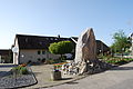
Artwork in the village center


Political communities in the Gäu district