Upper Lusatian mining area
The Upper Lusatian mining district is a mining district in the triangle of Saxony , Poland and the Czech Republic . It is located in Eastern Upper Lusatia ( Görlitz district , Powiat Zgorzelecki ).
Mining area
The mining area was mainly characterized in the 19th and 20th centuries by lignite extraction in open-cast mining , and before that also in mining . However, the mining did not reach such dimensions as in the Lusatian lignite mining district further north .
Lignite mining was already considerable in the first half of the 19th century. In the vicinity of the city of Zittau, numerous mine owners operated coal production in order to offer it as fuel for the population and factories as well as for agricultural purposes (fertilization). The increased interest in this raw material at the beginning of industrialization meant that mining experts and geologists examined the regions known for lignite more closely. In 1840 Bruno Geinitz published his results, which he had previously collected during field inspections with the mining authority Hallbauer. He encouraged further exploratory drilling. Since around 1820, targeted boreholes to determine the extent of the seam have been drilled.
The largest opencast mines are or were:
- Berzdorf opencast mine (today: Berzdorfer See )
- Zittau lignite basin
- Turów opencast mine between Bogatynia (Reichenau) and Zittau
- Open pit "Hercules" near Turoszów (Türchau)
- Opencast mine Olbersdorf (today: Olbersdorfer See )
- Olbersdorf mines
- Kristýna opencast mine , Hrádek nad Nisou (today a bathing lake and recreational area)
The electricity generation and refinement took place mainly in
- Hirschfelde power plant (1911–1992)
- Hagenwerder power plant (1973–1997)
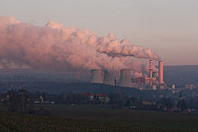
- Turów Power Plant (since 1962)
- Briquette factories in Hirschfelde
- Hercules lignite plant in Hirschfelde
Landscape change
The many years of active exploitation of powerful Miocene lignite formations in some areas led to a profound restructuring and devastation of the original natural area. Valuable nature reserves were partially lost. Dumps and heaps as well as open-cast mining holes, some of which are filled with water, shape the landscape. The Upper Lusatian mining area is thus a "technogenic natural space unit" that has the typical ecological features and also problems of mining landscapes . It can hardly be compared with natural spaces that have "grown" over long periods of time. Mining-related properties are, among other things, the relative lack of nutrients, large-scale structures, the heterogeneity of the soil substrates and the sustained dynamics in the remaining opencast pits.
See also
Individual evidence
- ↑ CF Naumann / B. Cotta: Explanations on the geognostic chart of the Kingdom of Saxony and the adjoining federal states. Explanations for Section VII . Dresden, Leipzig (Arnoldische Buchhandlung) 1840, pp. 33, 52–53

