Orford Ness
| Orford Ness | ||
 Modern and Historical Outline of Orford Ness |
||
| Geographical location | ||
|
|
||
| Coordinates | 52 ° 5 '3 " N , 1 ° 33' 19" E | |
| Waters 1 | North Sea | |
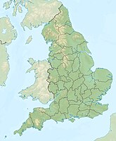
Orford Ness is located in the county of Suffolk on the south-east coast of Great Britain ( East Anglia region ). With an area of around nine square kilometers (with a length of around 15 kilometers), it is the largest vegetated spit in Europe. The peninsula is located at the mouth of the River Alde near the towns of Orford and Aldeburgh .
The peninsula features a lighthouse , the remains of a 19th-century defense tower, and some former 20th-century military installations where secret tests by the British Department of Defense were carried out during both World Wars and the Cold War , including those for (Next -) Development of nuclear weapons .
Today Orford Ness is a visitor-accessible nature reserve and is part of the National Trust . However, the former military buildings are closed to the public.
BBC broadcasting system
On the peninsula, a large and well-known was transmitting plant for medium wave of the BBC World Service , the Foreign Service of the BBC . For the frequency 648 kHz, a directional antenna consisting of five 106.7 meter high, free-standing , self-radiating towers isolated from earth , and for the frequency 1296 kHz one of six free-standing self-radiating towers isolated from earth were used as the transmitting antenna .
The buildings of the former experimental over-the- horizon radar system Cobra Mist were used for this . The operation of the transmitter was ended in May 2012 after around 30 years of operation.
