Paint (Pennsylvania)
| Paint | ||
|---|---|---|
|
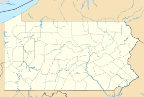
Location in Pennsylvania
|
||
| Basic data | ||
| Foundation : | 1900 | |
| State : | United States | |
| State : | Pennsylvania | |
| County : | Somerset County | |
| Coordinates : | 40 ° 15 ′ N , 78 ° 51 ′ W | |
| Time zone : | Eastern ( UTC − 5 / −4 ) | |
| Residents : | 1,023 (as of 2010) | |
| Population density : | 1,136.7 inhabitants per km 2 | |
| Area : | 0.9 km 2 (approx. 0 mi 2 ) of which 0.9 km 2 (approx. 0 mi 2 ) is land |
|
| Postal code : | 15963 | |
| Area code : | +1 814 | |
Paint is a borough in Somerset County , Pennsylvania , United States , eight miles southeast of Johnstown . It borders directly on the boroughs Windber in the southeast (Somerset County) and Scalp Level ( Cambria County ) in the north. Paint was founded in 1900 and has a population of 1,023 (according to the 2010 census ).
history
| growth of population | |||
|---|---|---|---|
| Census | Residents | ± in% | |
| 1910 | 999 | - | |
| 1920 | 1283 | 28.4% | |
| 1930 | 1336 | 4.1% | |
| 1940 | 1700 | 27.2% | |
| 1950 | 1547 | -9% | |
| 1960 | 1275 | -17.6% | |
| 1970 | 1233 | -3.3% | |
| 1980 | 1177 | -4.5% | |
| 1990 | 1091 | -7.3% | |
| 2000 | 1103 | 1.1% | |
| 2010 | 1023 | -7.3% | |
| Source: United States Census | |||
At the end of the 19th century, the Berwind-White Coal Mining Company began to buy up land in northern Somerset County and southern Cambria County to mine the coal deposits of the Allegheny Mountains . The only settlement at the time was the small village of Scalp Level on the southern border of Cambria County. In 1897, the Berwind-White Coal Mining Company founded the town of Windber and started coal mining in the region . 1900 Windber was to receive the status of a borough , but some farmers did not want to be part of this administrative district controlled by the mining company, whereupon the responsible judge established two adjacent boroughs; Windber to the southeast and Paint to the northwest.
Until 1900, Windber and Paint belonged to the Paint Township , which at that time had a total population of 6,835. In 1910, Windber already had over 8,000 inhabitants and Paint 1,000. With the decline in coal mining, Windber's population has halved to around 4,000 to this day, while that of Paint has fluctuated since the 1990s - after a high of over 1,500 in the 1940s - around 1000 residents.
Windber Historic District
Much of the founding historic buildings in Windber, as well as some buildings in Paint and the adjacent community of Scalp Level in Cambria County, were added to the National Register of Historic Places in 1991 as the Windber Historic District (NRHP #: 91001705).
literature
- Mildred Allen Beik: The Miners of Windber: The Struggles of New Immigrants for Unionization, 1890s-1930s. Penn State Press, 2006, ISBN 978-0271029900 .
Individual evidence
- ^ Pennsylvania: 2010, Population and Housing Unit Counts. US Department of Commerce Economics and Statistics Administration, 2012. Retrieved February 5, 2015.
- ↑ a b Census of Population and Housing 1790-2010. US Census Bureau. Retrieved February 7, 2015.
- ^ Mildred Allen Beik: The Miners of Windber: The Struggles of New Immigrants for Unionization, 1890s-1930s. Penn State Press, 2006, pp. 11-25.
- ↑ Jaclyn LaPlaca: Somerset County: Pride Beyond the Mountains. Arcadia Publishing, 2003, ISBN 978-0738524528 , p. 50.
- ↑ Gerald M. Kuncio: Windber Historic District - National Register of Historic Places Registration Form. United State Department of the Interior, National Park Service, 1991.
