Paklenica National Park
| Paklenica National Park | ||
|---|---|---|
| Paklenica gorge seen from the sea | ||
|
|
||
| Location: | Zadar , Croatia | |
| Specialty: | Habitat of many endangered animal species | |
| Next city: | Zadar | |
| Surface: | 96 km² | |
| Founding: | 1949 | |
| Visitors: | unknown | |
| Address: |
www.paklenica.hr Dr. F. Tuđmana 14a HR - 23244 Starigrad-Paklenica Tel. +385 23 369 155 |
|
| Rock hell | ||
| Deep beech forests | ||
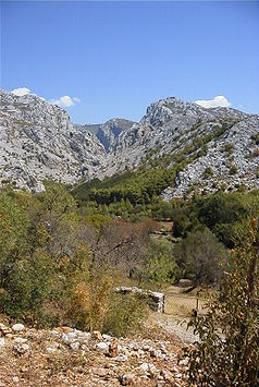
The Paklenica National Park is a national park in the Velebit mountain range 30 km northeast of the city of Zadar on the Croatian Adriatic Sea and about one kilometer from Starigrad-Paklenica . It was declared a national park in 1949. The highest peaks are Vaganski Vrh with 1757 m. i. J. and Sveto Brdo ( 1750 m. I. J. )
Paklenica means "little hell" in Croatian. The name probably originated from the rough and steep karst rocks that house numerous hidden caves and, when illuminated by the sun, awaken the association with the underworld. An alternative explanation traces the name back to the common black pines in the park, whose sap ( paklina ) was previously used to impregnate boats.
The total area of this national park is 96 square kilometers. The National Park provides habitat for numerous rare and protected species: chamois , deer , brown bear , lynx , wolf , snake eagles , griffon vultures live in the national park. In addition, numerous reptiles live in Velebit: poisonous horned vipers and adders are relatively common in the Karst of Croatia.
Film location
Since the Paklenica Gorge is similar to American canyons in the Wild West , it was used as the backdrop for the Winnetou film The Treasure in Silver Lake in 1962 . The filming locations are easy to find thanks to signs.
Climb
The national park has a large climbing area with over 400 routes of varying degrees of difficulty.
hike
To get to know the diversity of the park, 150 km of marked hiking trails are available. In some areas it is strongly advised not to leave them due to the persistent danger of landmines . Camping is not permitted in the park, but some mountain huts and (free) shelters are available for hikers. There is enough water in the park and it is of drinkable quality.
literature
- B. Čujić: Paklenica Climbing Guide .
- Nacionalni park Paklenica: Paklenica planiarska karta . Astroida. Zagreb. ISBN 978-953-6912-05-6
Web links
- www.paklenica.hr - Paklenica National Park (English)
- www.berghaben.com - climbing in Paklenica
- www.faszination-kroatien.de - Page about the Paklenica National Park
- Excursion destination in Croatia - Velika and Mala Paklenica
- [1] - Croatia / Dalmatia / National parks
- Paklenica - pictures from the gorge and the "Anica kuk" peak


