Palar
| Palar | ||
|
Course of the Palar |
||
| Data | ||
| location | Karnataka , Andhra Pradesh , Tamil Nadu (India) | |
| River system | Palar | |
| source | Nandi Hills | |
| muzzle |
Bay of Bengal Coordinates: 12 ° 28 ′ 4 " N , 80 ° 9 ′ 16" E 12 ° 28 ′ 4 " N , 80 ° 9 ′ 16" E
|
|
| length | 357 km | |
| Left tributaries | Ponnai | |
| Right tributaries | Cheyyar | |
| Big cities | Ambur , Vellore , Kanchipuram | |
| Medium-sized cities | Vaniyambadi , Arcot , Chengalpattu | |
|
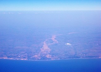
Aerial view of the mouth of the Palar |
||
The Palar ( Tamil : பாலாறு , Kannada : ಪಾಲಾರ್ ನದಿ, Telugu : పాలార్ నది) is a max. 357 km long river in southern India . Its amount of water is subject to strong periodic fluctuations and reaches its maximum during the monsoon season .
course
The Palar River rises in the Nandi Hills northwest of the city of Kolar in the Indian state of Karnataka , then flows in mostly east or south-east direction 93 km through Karnataka, 42 km through Andhra Pradesh and 222 km through Tamil Nadu to the Coromandel Coast , where it is almost 70 km flows south of Chennai into the Bay of Bengal .
Tributaries
The main tributaries of the Palar are the Ponnai and the Cheyyar , but the Palar has suffered for years - especially in its upper reaches - from water scarcity, which is supposed to be alleviated by inflow channels from other rivers.
Cities
Important cities on the banks of the Palar are Vaniyambadi , Ambur , Vellore , Arcot , Kanchipuram and Chengalpattu .
Leather industry
Many of the largely Muslim cities on the middle reaches of the Palar have dedicated themselves to the production and processing of leather.
literature
Web links
- Palar River - Photos + Info (English)

