Parque Estadual dos Pirineus
| Parque dos Pirineus | |||
|---|---|---|---|
| map | |||
|
|||
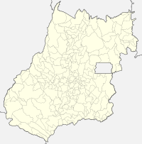
The Parque dos Pirineus (German: State Park in the Pyrenees Mountains ) or Parque Estadual da Serra dos Pireneus is located in the northern end of the Serra dos Pireneus in the Brazilian state of Goiás between the municipalities of Pirenópolis , Cocalzinho de Goiás and Corumbá de Goiás in the microregion Entorno de Brasília .
The park was created in 1987 to protect one of the highest mountain peaks in the state of Goiás, the Pico dos Pireneus , and covers an area of 2833.26 hectares with a circumference of 28,118.6 m.
Physiognomic features
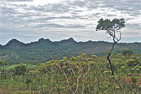
The main features of the Pirineus Park are sandstone and quartzite rock formations from the Precambrian and where some endemic species are found. Almost all of them are located above 1200 m. Although the park is small, all the physiognomic features of the Cerrado can be found : rocky field and forest landscapes, damp and semi-flooded grasslands, semi-decayed forests, hilly landscapes, gallery forests along rivers, etc.
Tourist destinations
The park is located south of the, here unpaved, BR-070 . It is located 20 km from the town of Pirenópolis and 6 km from the town of Cocalzinho de Goiás and is accessible via a dirt road. It is administered by the State Secretariat for Environment and Water Management ( SEMARH: Se cretário do M eio A mbiente e dos R ecursos H ídricos ). The park is unmanned and access is not controlled. Popular destinations in and around the park are:
- Pico dos Pireneus , at 1385 m the highest point in the region
- Morro Cabeludo is a prominent mountain range south of the park that is popular with climbers
- Pocinhos do Sonrisal (Capitão do Mato: bush cape ) Wonderful natural pools near river springs
- Hiking trails through typical cerrado vegetation for ecotourism
- Bathing in one of the numerous waterfalls and pools
It is recommended, although not mandatory, to be accompanied by a tourist guide, as there are practically no signposts and no marked paths to the most beautiful corners of the park. Specialized guides can be found in Pirenópolis.
Hydrography
The park is located in the area of the continental watershed , in which many tributaries to the Tocantins and Paraná river systems arise, such as B. the Rio das Almas ( river of souls ), which rises in the west at the park boundary and the Rio Corumbá , whose source is located at the northern park boundary.
Web links
- Portal do Turismo de Pirenópolis , (Portuguese)
- Serviço Geológico do Brasil : Contexto Histórico da Região do Geoparque Pireneus , (Portuguese)
- Agência Ambiental de Goiás:
- Projeto Parque Vivo chega ao Parque dos Pireneus (08/21/2006) , (Portuguese)
- AGMA anuncia benfeitorias no Parque dos Pireneus (22/08/2006) , (Portuguese)
- WWF: Cerrado , photos , (English)
- Google Books: Travel Guide: Brazil , by Regis St. Louis, Andrew Draffen
Coordinates: 15 ° 47 ′ 44 ″ S , 48 ° 50 ′ 57 ″ W.


