Patrol notch
| Patrol notch | |||
|---|---|---|---|
|
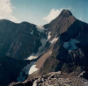
The Patrolscharte between Gatschkopf (left) and Parseierspitze (right) from the north |
|||
| Compass direction | north | south | |
| Pass height | 2846 m above sea level A. | ||
| state | Tyrol | ||
| Watershed | Lochbach → Inn | Gasillbach → Sanna | |
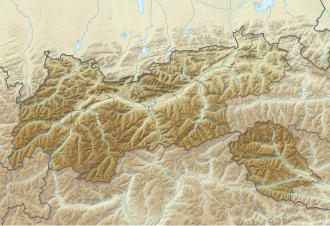
| Map (Tyrol) | |||
|
|
|||
| Coordinates | 47 ° 10 '27 " N , 10 ° 28' 56" E | ||
The Patrolscharte is an alpine path crossing at an altitude of 2846 m above sea level. A. in the Parseiergruppe , a mountain range in the Lechtal Alps . It is located in the Austrian state of Tyrol , about four and a half kilometers as the crow flies northwest of Grins in the Stanzer Valley . On the saddle of the meeting Ansbacher Hut , located in the west on 2376 meters above sea level, coming Augsburger trail and running in a north-south direction Spiehlerweg between the Memminger hut (2242 m) and the Augsburger hut (2298 m) together. The Patrolscharte lies between the 3036 meter high Parseierspitze in the west and the Gatschkopf (2945 m) in the east. The south side slope drains over the Gasillbach into the Sanna , the north side over the Lochbach into the Inn .
Literature and map
- Dieter Seibert: Alpine Club Guide Lechtal Alps , Munich 2002, ISBN 3-7633-1268-4
- Alpine club map 1: 25,000, sheet 3/3, Lechtal Alps, Parseierspitze


