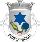
Pedro Miguel
| Pedro Miguel | ||||||
|---|---|---|---|---|---|---|
|
||||||
| Basic data | ||||||
| Autonomous Region : | Azores | |||||
| Concelho : | Horta | |||||
| Coordinates : | 38 ° 35 ′ N , 28 ° 37 ′ W | |||||
| Residents: | 759 (as of June 30, 2011) | |||||
| Surface: | 14.48 km² (as of January 1, 2010) | |||||
| Population density : | 52 inhabitants per km² | |||||
| Postal code : | 9900-427 | |||||
| politics | ||||||
| Mayor : | José da Terra Carlos ( PPD / PSD - CDS / PP coalition) | |||||
| Address of the municipal administration: | Junta de Freguesia de Pedro Miguel Estrada Regional 9900-427 Pedro Miguel |
|||||
Pedro Miguel is a village and a municipality on the island of Faial , which belongs to the Portuguese archipelago of the Azores .
The viewpoint Miradouro do Cabouco at the 1043 m high Alto do Cabouco offers wide views over the municipality, in which the Parque Florestal do Cabouco is also a forest area, which is also important as a recreational area. A popular photo motif is the former parish church Igreja de Nossa Senhora da Ajuda , which was badly damaged in the earthquake of July 9, 1998, but remained standing. It is still a listed building.
history
The place name probably goes back to one of the first settlers.
In 1600 the Pedro Miguel parish was founded and the parish church was built. The small fortification Forte Baixo then guarded the small fishing port. In 1643 the community had 384 inhabitants in 113 households.
Pedro Miguel was badly damaged by an earthquake on July 9, 1998. The ruins of the three-aisled church, which collapsed in the quake and was subsequently ravaged by fire and not rebuilt, rise in the center of the village.
administration
Pedro Miguel is the seat of a municipality of the same name ( freguesia ) in the district ( concelho ) of Horta . The municipality has an area of 14.5 km² and its population was 759 on June 30, 2011.
The following places and districts are in the municipality:
- Cabeço Redondo
- Canada do Cabeço Redondo
- Grota Funda
- Pedro Miguel
Web links
- Website on the Pedro Miguel parish at the Horta district administration
- Entry on Pedro Miguel in the Mapas de Portugal
Individual evidence
- ↑ www.ine.pt - indicator resident population by place of residence and sex; Decennial in the database of the Instituto Nacional de Estatística
- ↑ Overview of code assignments from Freguesias on epp.eurostat.ec.europa.eu
- ^ Entry of the Igreja de Nossa Senhora da Ajuda in the Portuguese list of monuments SIPA, accessed on October 21, 2019
- ↑ Passage on the history of the community in the entry on Pedro Miguel in the Portuguese National Archives Torre do Tombo , accessed on October 22, 019
- ↑ Michael Bussmann: Azoren , p. 365. Erlangen 2016


