Perche (Isac)
| Perche | ||
|
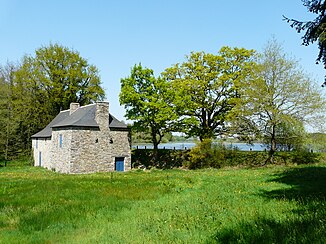
The Etang de Clegreuc is traversed by the Perche |
||
| Data | ||
| Water code | FR : J9124000 | |
| location | France , Pays de la Loire region | |
| River system | Vilaine | |
| Drain over | Isac → Vilaine → Atlantic Ocean | |
| source | on the municipal boundary of Marsac-sur-Don and Vay 47 ° 34 ′ 6 ″ N , 1 ° 41 ′ 39 ″ W |
|
| Source height | approx. 77 m | |
| muzzle | in the parish of Blain in the Isac coordinates: 47 ° 27 ′ 43 ″ N , 1 ° 45 ′ 9 ″ W 47 ° 27 ′ 43 ″ N , 1 ° 45 ′ 9 ″ W |
|
| Mouth height | approx. 13 m | |
| Height difference | approx. 64 m | |
| Bottom slope | approx. 2.9 ‰ | |
| length | approx. 22 km | |
| Left tributaries | Cep | |
| Reservoirs flowed through | Etang de Clegreuc | |
The Perche is a river in France that runs in the Loire-Atlantique department in the Pays de la Loire region . It rises on the municipal boundary of Marsac-sur-Don and Vay , drains in several loops generally towards the south-southwest and flows into the Isac as a right tributary after about 22 kilometers in the municipality of Blain .
Places on the river
(Order in flow direction)
- Le Gâvre
- L'Étriché , municipality of La Grigonnais
- Le Perche , Blain parish
