
Ko Pha-ngan
| Ko Pha-ngan | ||
|---|---|---|
 |
||
| Waters | Gulf of Thailand | |
| Archipelago | Mu Ko Samui | |
| Geographical location | 9 ° 45 ' N , 100 ° 2' E | |
|
||
| length | 18.6 km | |
| width | 12 km | |
| surface | 125 km² | |
| Highest elevation | Khao Ra 635 m |
|
| Residents | 8000 64 inhabitants / km² |
|
| main place | Thong Sala | |
 |
||

Ko Phangan (also Koh Pha Ngan or Koh Phangan , Thai : เกาะพะงัน , pronunciation: [ kɔʔ pʰáʔŋan ]) is an east of the Isthmus of Kra located island in the Gulf of Thailand .
Pha-ngan is also the headquarters of the administrative district ( Amphoe - Administrative District ) Amphoe Ko Pha-ngan of Surat Thani Province .
geography

Ko Pha-ngan is 60 km northeast of mainland Thailand . With an area of 125 km², it is the second largest island of the Samui Archipelago ( Muu Ko Samui ), named after the neighboring island about 15 km to the southwest , to which about 60 other islands belong; including Ko Tao , Ko Nang Yuan and the approximately 40 islands of the Ang Thong National Park (location of the novel The Beach , but not the location of the associated film The Beach ). Directly off the coast of Ko Pha-ngan there are a number of very small (approx. 1 km² and smaller) uninhabited islands, such as Ko Tae Nok and Ko Tae Nai in the west, Ko Maa in the northwest or Ko Kong Than Sadet in the east.
The interior is mostly mountainous and covered by primeval forest and partly by secondary forest. The highest mountain is the 635 m high Khao Ra in the north of the island.
The capital and most important port is Thong Sala ( ท้อง สา ลา ). The following regular ferry connections exist:
- from Thong Sala to the provincial capital Surat Thani on the mainland,
- from Thong Sala by catamaran ferry without changing via Koh Tao to Chumphon , also on the mainland, and from there on with the same company by bus to Bangkok,
- from Thong Sala to the northern neighboring island of Ko Tao ,
- from Thong Sala to Na Thon as well as to Bo Phut on Ko Samui (the connection to Mae Nam only takes place in the main season, i.e. from around December to May. As of December 2013) and
- from Haad Rin to Bo Phut (Ko Samui).
Residents
Half of the approximately 10,000 inhabitants live in Thong Sala. The rest is distributed among the 15 or so villages, most of which are on the coast. The population is around 90% of Thai , the followers of continental Southeast Asia widespread Theravada - Buddhism are. There is also a Chinese community in the capital , mostly descendants of fishermen who immigrated from the island of Hainan at the beginning of the 20th century , and in the village of Ban Kai , in the southwest of the island, a small Muslim community.
Economy and tourism


As on the larger sister island Ko Samui , the management of palm plantations and fishing have traditionally been the most important economic sectors. Even today they are the largest sources of income after tourism. Above all, the copra obtained from coconuts is exported . In addition, the fibers of the nuts are used to make mats, the wood is used as a building material and for the manufacture of everyday objects and the leaves are still often used to cover houses. Another agricultural product on the island is rubber .
Since the 1980s tourism has also been increasing on Ko Pha-ngan. After Samui had already been largely developed for tourism, especially after the opening of the airport there, many of the long-distance travelers were looking for the very calm and contemplative atmosphere of Samui compared to other tourist destinations in the region (e.g. Phuket , Bali ) had enjoyed an alternative - and found it on the more impassable neighboring island of Pha-ngan. The beaches on the east coast, where the mountains often reach the sea, are still mostly only accessible with the traditional long boats of the fishermen, which also serve as water taxis. Only in two places, at Haad Sadet and the two parts of Thong Nai Pan Beach, are there more or less paved road connections to the main road on the west side of the island.
Party scene
In addition to the island's capital, the town of Hat Rin , located near the southern tip of Pha-ngan ( Haad Rin ), is increasingly developing into the island's tourist center. Especially in the days immediately before and after full moon nights, young travelers and DJs from all over the world meet here every month for the Full Moon Party and numerous other parties such as Oxa Beach or the Jungle Party . The Full Moon Party began in the late 1980s. Today, in the high season from December to February, over 10,000 ravers come together to celebrate until sunrise , especially on the beach at Hat Rin Nok , the eastern, sunrise-facing side of the isthmus. The Full Moon Party is still known for the high drug consumption of many visitors, which is threatened with severe penalties in Thailand and while the party, including with civil investigators, has been intensified since the beginning of the 21st century. Nevertheless, there have been several fatal incidents there. Women and girls have been repeatedly raped by participants under the influence of alcohol or other drugs . Since religious holidays often coincide with full moon nights in Buddhist Thailand and parties are not welcome on such days, they sometimes take place on the night shortly before or after the actual full moon.
Attractions
- The National Park Than Sadet-Ko Pha-ngan is located in the northeast of the island. The approximately 65.93 km² park was opened on December 31, 1983.
Impressions from the island

Wat Khao Noi, one of the oldest temples on the island

Hat Tien Bay

Sunset at Ao Wok Tum

Long Tail Boat at Bottle Beach
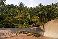
Lonely beach in the east of the island


Web links
Individual evidence
- ↑ UNEP Islands (English)
- ^ German Embassy Bangkok Thailand: Travel and safety information