Piz Grisch
| Piz Grisch | ||
|---|---|---|
|
Piz Grisch, recorded by Ausserferrera |
||
| height | 3062 m above sea level M. | |
| location | Canton of Graubünden , Switzerland | |
| Mountains | Oberhalbsteiner Alps | |
| Dominance | 6.59 km → Piz Forbesch | |
| Notch height | 547 m ↓ Fuorcla Starlera | |
| Coordinates | 756 052 / 155346 | |
|
|
||
| First ascent | 1861 by Christian Hössli (official) | |
| particularities | In the past, iron was mined on Piz Grisch | |
|
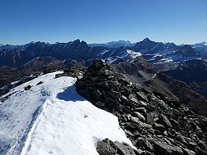
Steinmann on the Piz Grisch |
||
The Piz Grisch ( Rhaeto-Romanic for gray peak ) is a mountain northeast of Innerferrera in the canton of Graubünden in Switzerland with an altitude of 3,062 m above sea level. M. Especially to the west, it offers a view with an exceptional view.
The first to climb is Christian Hössli, born in 1861, on the occasion of an eagle hunt. Shepherds had reached the summit earlier, however. Piz Grisch used to be called Piz Fianell . The Dufour card referred to it as Piz Starlera . Iron was once exploited on the slopes of Piz Grisch.
Location and surroundings
The Piz Grisch is the namesake of the Piz Grisch group , a subgroup of the Oberhalbsteiner Alps . It is located entirely in the municipality of Ferrera , on the border between the Innerferrera and Ausserferrera fractions .
The neighboring peaks include the Piz digl Gurschus , the Piz Settember , the Piz Alv , the Piz Starléra and the Piz la Mazza .
On the north flank, the Piz Grisch has a glacier, the Glatscher da Sut Fuina .
Valley locations are Ausserferrera and Innerferrera. A common starting point is radon.
Routes to the summit
Over the northwest ridge
- Starting point: Ausserferrera ( 1300 m )
- Difficulty: WS
- Time required: 5¼ hours
Through the flank of the northeast ridge
- Starting point: Fuorcla Cotschna ( 2516 m ), Radons ( 1866 m ) or Ausserferrera ( 1300 m )
- Difficulty: L
- Time required: 2½ hours from Fuorcla Cotschna, 4¾ hours from Radons or 5¾ hours from Ausserferrera
About the Laiets
Variant frequently used by radons
- Starting point: Fuorcla Cotschna ( 2516 m ) or Radons ( 1866 m )
- Difficulty: L
- Time required: 2½ hours from Fuorcla Cotschna or 4¾ hours from Radons
Over the northeast ridge
Hardly a worthwhile option
- Starting point: Fuorcla Cotschna ( 2516 m ), Radons ( 1866 m ) or Ausserferrera ( 1300 m )
- Difficulty: WS
- Time required: 2¾ hours from Fuorcla Cotschna, 5 hours from Radons or 6 hours from Ausserferrera
Over the southeast ridge
- Starting point: Fuorcla Cotschna ( 2516 m ) or Radons ( 1866 m )
- Difficulty: WS-
- Time required: 2½ hours from Fuorcla Cotschna or 4¾ hours from Radons
About the Cuolmet
- Starting point: Innerferrera ( 1480 m )
- Difficulty: WS-
- Time required: 5 hours
Over the Alp Mos
- Starting point: Ausserferrera ( 1300 m )
- Difficulty: WS-
- Time required: 5¾ hours
Over the south ridge
- Starting point: Innerferrera ( 1480 m )
- Difficulty: WS
- Time required: 4½ hours
Through the hollow of Pariel
- Starting point: Innerferrera ( 1480 m )
- Difficulty: WS
- Time required: 4¾ hours
panorama
gallery
Piz Grisch, recorded from Piz digl Gurschus
View down to Ausserferrera
literature
- Manfred Hunziker: Club Guide, Bündner Alpen, Volume 3 (obverse) 1st edition. Verlag des SAC, 1994, ISBN 3-85902-140-0 , pp. 277-282.
- National map of Switzerland, sheet 1255 Splügenpass, 1: 25000, Federal Office of Topography, edition 2001
- Faust Signorell, Vocabulari - dictionary surmiran-tudestg / deutsch-surmiran , Lehrmittelverlag Graubünden 1999
Web links
- Piz Grisch on the ETHorama platform
- Panorama from Piz Grisch
- www.hikr.org Tour report


