Plauer See (Brandenburg)
| Plauer See | ||
|---|---|---|

|
||
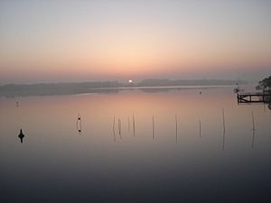
| Sunrise over the Plauer See on April 12, 2007 | ||
| Geographical location | Brandenburg an der Havel , Brandenburg, Germany | |
| Tributaries | from Quenzsee ( Silokanal ), Breitlingsee with Brandenburger Niederhavel , Möserschen See | |
| Drain | Havel | |
| Islands | Willow bush | |
| Data | ||
| Coordinates | 52 ° 23 '45 " N , 12 ° 26' 0" E | |
|
|
||
| surface | 6.4 km² | |
| Maximum depth | 6.7 m | |
The Plauer See is part of the lake district in Brandenburg an der Havel , which includes the Plauer, for example, the Quenzsee , Breitlingsee , Mösersche See and Wendsee . The Havel flows through it and covers an area of around 640 hectares . Its maximum depth is given as 6.7 m.
Surname
The name of the Plauer See is derived from the Plaue part of the city of Brandenburg an der Havel. The name of the town probably comes from the old Polish plavati , which translates as raft, to flood . The formerly independent fishing town is located in the northwest of the lake. On this bank, at the outflow of the Havel, is Plaue Castle with its park.
location
The lake area of the Plauer See lies west of the core city area of Brandenburg an der Havel in the Niederhavel area, but is strictly speaking part of the middle Havel section. In the east, the Plauer See begins on the Enge to Quenzsee. In the southeast it is bounded by the Wusterau peninsula . Plauerhof is located in the north. In the northwest, the Havel leaves the Plauer See in the direction of Rathenow . The entire north-western bank is formed by the Plaue Castle Park. In the west, the Plauer See merges into the Großer Wendsee before the Seegartenbrücke between the Brandenburg districts of Kirchmöser and Plaue. The southern bank is occupied by the districts of Kirchmöser West and Kirchmöser East.
meaning
The Plauer See is part of the federal waterway Untere Havel waterway with the waterway class IV, for which the waterways and shipping authority Brandenburg is responsible. As part of traditional commercial fishing, the lake is fished intensively by Plauer fishermen. Many bank areas are therefore equipped with fish traps . Many water sports enthusiasts use the water as a field of activity. The Kirchmöser power plant takes cooling water from the lake.
See also
Web links
Individual evidence
- ↑ a b Brandenburg an der Havel , In: Landscapes in Germany - Values in Germany. A regional study in the Brandenburg an der Havel , Pritzerbe, Rekahn and Wusterwitz area. Edited by Sebastian Kinder and Haik Thomas Porada on behalf of the Leibniz Institute for Regional Geography and the Saxon Academy of Sciences in Leipzig, Volume 69, Böhlau, Cologne / Weimar / Vienna 2006, ISBN 3-412-09103-0 , p. 265 .
- ↑ Directory E, Ser. No. 60 of the Chronicle ( Memento of the original from July 22, 2016 in the Internet Archive ) Info: The archive link was inserted automatically and has not yet been checked. Please check the original and archive link according to the instructions and then remove this notice. , Federal Waterways and Shipping Administration
- ↑ Company - Eon invests in traction power plant. (No longer available online.) October 28, 2005, archived from the original on September 17, 2016 ; accessed on September 17, 2016 . Info: The archive link was inserted automatically and has not yet been checked. Please check the original and archive link according to the instructions and then remove this notice.

