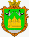
Pobuschany
| Pobuschany | ||
| Побужани | ||

|
|
|
| Basic data | ||
|---|---|---|
| Oblast : | Lviv Oblast | |
| Rajon : | Busk district | |
| Height : | 215 m | |
| Area : | 4.438 km² | |
| Residents : | 1,040 (2004) | |
| Population density : | 234 inhabitants per km² | |
| Postcodes : | 80513 | |
| Area code : | +380 3264 | |
| Geographic location : | 50 ° 1 ′ N , 24 ° 34 ′ E | |
| KOATUU : | 4620685063 | |
| Administrative structure : | 2 villages | |
| Address: | 80513 с. Побужани | |
| Statistical information | ||
|
|
||
Pobuschany ( Ukrainian Побужани ; Russian Побужаны , Polish Pobużany ) is a village in the north of the Ukrainian Lviv Oblast with about 1000 inhabitants (2004).
The village is the administrative center of the district council of the same name in Busk district , to which the village of Laneriwka ( Ланерівка ⊙ ) with about 30 inhabitants also belongs. Pobuschany is located on the bank of the Western Bug 8 km northwest of the Rajon center Busk and about 60 km northeast of the Oblast capital Lviv .
history
The village was mentioned in writing for the first time in 1433 and was initially part of the aristocratic republic of Poland in the Bełz Voivodeship . From 1772 to 1918 it belonged to Austrian Galicia under its Polish name of Pobużany .
After the end of the First World War , the place came to the West Ukrainian People's Republic and then to the Second Polish Republic (in the Tarnopol Voivodeship , Powiat Kamionka Strumiłowa , Gmina Busk ). During the Second World War it was occupied by the Soviet Union from September 1939 and by Germany between summer 1941 and 1944 and incorporated into the Galicia district.
After the end of the war, Pobuschany was added to the Soviet Union and joined the Ukrainian SSR . After the collapse of the Soviet Union , the village became part of the independent Ukraine in 1991.
Web links
- Pobużany . In: Filip Sulimierski, Władysław Walewski (eds.): Słownik geograficzny Królestwa Polskiego i innych krajów słowiańskich . tape 8 : Perepiatycha – Pożajście . Walewskiego, Warsaw 1887, p. 347 (Polish, edu.pl ).
Individual evidence
- ↑ Local website on the official website of the Verkhovna Rada , accessed on October 13, 2015
- ↑ Rizzi Zannoni, Woiewodztwo Ruskie, Część Krakowskiego, Sędomirskiego Bełzkiego y z y granicami Węgier, Polski, Które gory Karpackie nakształt łańcucha wyciągnione, od góry Wolska aż do Talabry, wyznaczaią .; 1772 ( Memento of the original from November 20, 2015 in the Internet Archive ) Info: The archive link was inserted automatically and has not yet been checked. Please check the original and archive link according to the instructions and then remove this notice.

